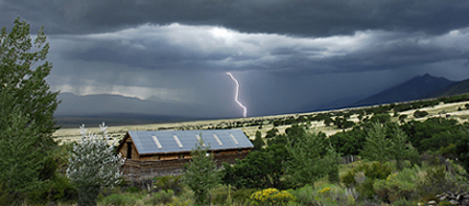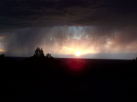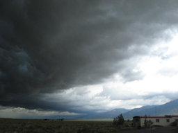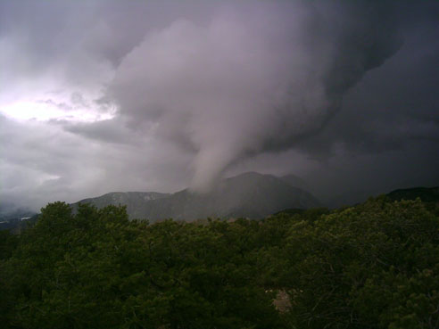
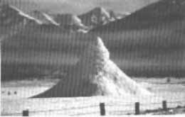
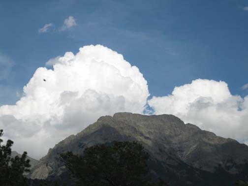
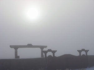
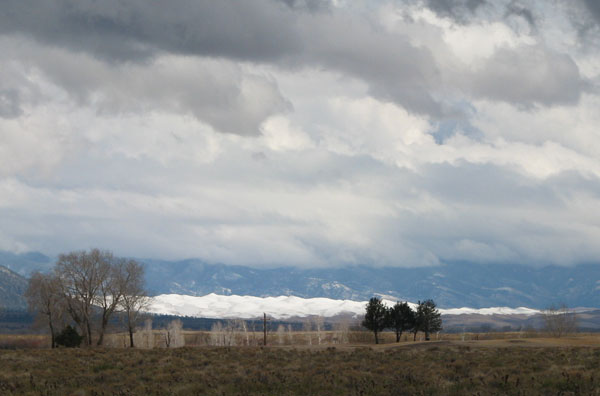
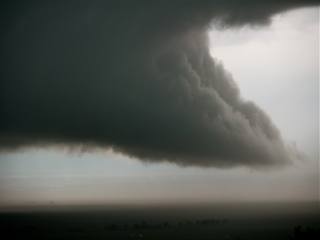
Funnel Cloud, just before it hit the mountain above Crestone, April 24, 2005
(Photo sent in by Jeanne Sullivan)
Crestone
Weather Center
Keno's Home and Crestone's Official
Weather Station
Crestone Weather Photos
This page shows some of the more interesting weather that we have experienced here in Crestone. Anybody reading this who has any cool photos of storms or weather events from years past - or up to the present - and who would like to share them here, please send them on in to me. Photos of interest would include snowstorms, floods, hail, ice fog, rainbows, etc. Please send photos in via email, along with: where and when the photo was taken; and who took the photo, so I can give the proper credit. Please include "Crestone Weather Photos" in the email's subject title. Only rule is that the photos must be local, preferably taken in and around the Crestone-Baca area.
Note: The newest photos can be found on the bottom of the page.
Thanks to all who have sent in photos!
- Crestone Weather Photos -
(Page last update in Oct 22, 2024)
Funnel Cloud, just before it hit the mountain above Crestone,
April 24, 2005
(Photo sent in by Jeanne Sullivan)
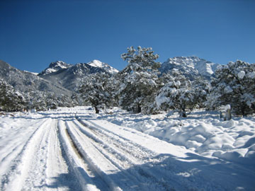
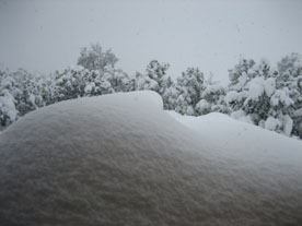
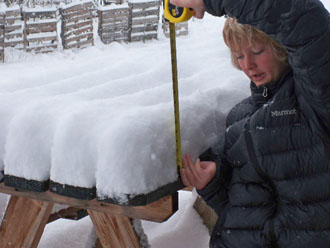
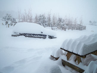
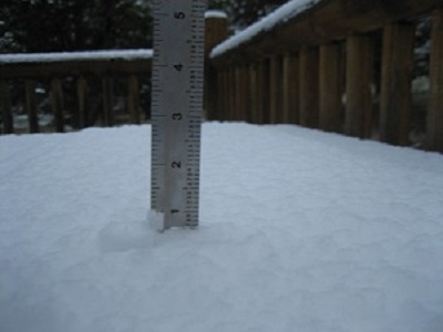
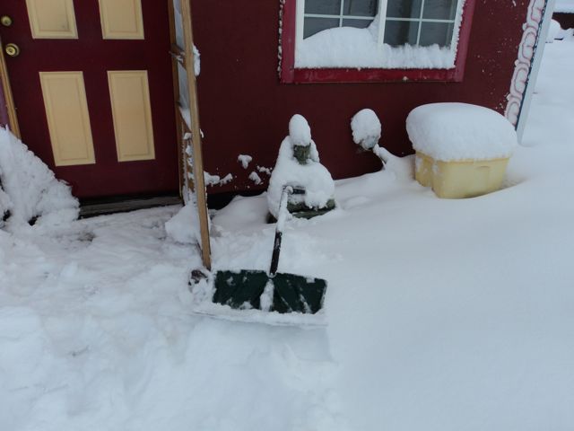
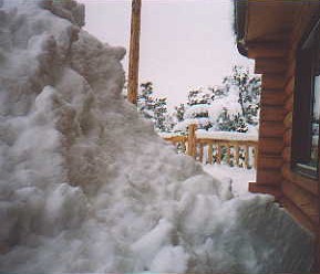 Back Deck of Keno's House... (1) ...after 31 inches of snow fell on March 13, 2003, located south of the Baca Fire Station in the Chalets. |
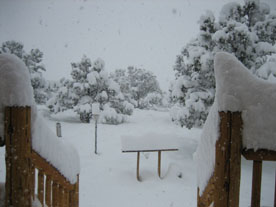
 Front Deck of Keno's House (2) From March 13, '03 - Can you make out the burried 2 1/2' tall table? It's in the middle of the photo. |
 Frozen Artesian Spring next to Casita Park Notice the ice fog just behind it. This was taken by Bill Hill in the early 1960s, where the lake bed now sits. |
 Frozen Artesian Spring w/water shoting out Wish we had a larger photo of this one! Located across T Road from Casita Park, and taken by Bill Hill in the early '60s. |
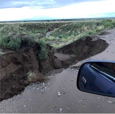
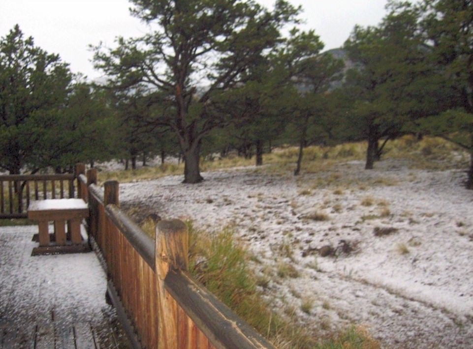
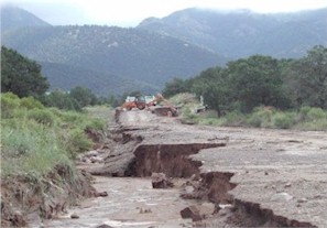 Flood Damage to road on Panorama, in Chalet One (1) Caused by a flash flood that hit on July 28, 2003, after 1.5" of rain fell in less than 20 minutes. |
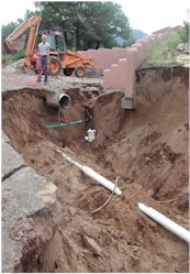 Flood Damage to infrastructure in Chalet One (2) After flash flood hit on July 28, 2003 (This photo and the one to the left sent in by Janet Woodman) |
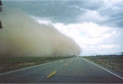 Duststorm getting ready to hit - June 3, 2005 (1) Looking North on Hwy 17 it's about to hit Hooper , CO |
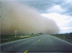 Duststorm Hitting Hooper, CO (2) Taken again on Hwy 17 seconds later |
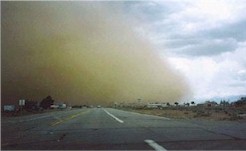 Duststorm hits Hooper, CO, Crestone is next! (3) Storm is heading Eastward with winds between 50 & 70 MPH |
 Hwy 17 between Hooper & Moffat, Co (4) Inside the storm, all photos taken by Fred Farrell |
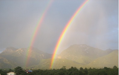
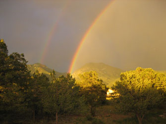
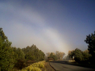
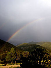
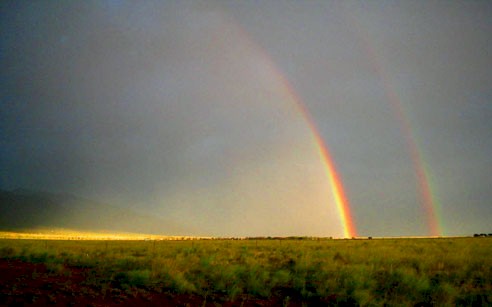
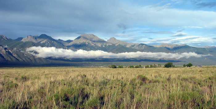
- Some Double Rainbows over Crestone -
|
|
A hawk flies by a building cumulonimbus cloud
over Mount Crestone, July, 2006
(This and rainbow photos taken by Keno)
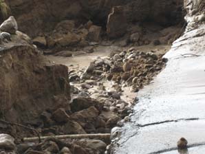
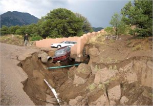
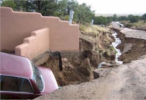
- The following photos are of the
Flash Floods that hit on July 3, 2006 -
(All photos below taken by Keno)
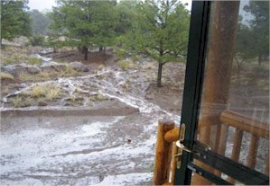 Flash flood as it was taking place by our front door |
 Damage to side of Camino Baca Grande Rd |
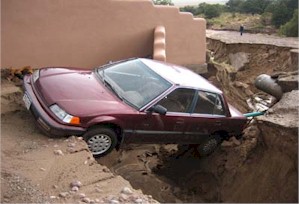 Car eaten up by flood on Panorama Way
|
 Panorama Way |
 Looking down Panorama Way |
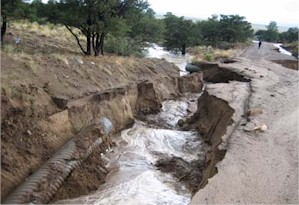 Panorama Way |
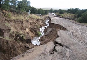 Panorama Way |
|
- For more flash flood photos from the July 3 storm, click here -
|
|
(Next 2 photos by Keno)
|
|
Morning freezing fog at Crestone's Dragon Mountain Zen Temple
December, 2006 (Photo by Steve Allen)
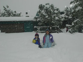
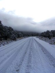
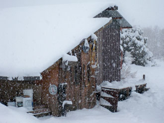
- The following photos are from a 23.6" spring snowstorm that hit on April 23, 2007 -
|
|
|
. |
|
|
|
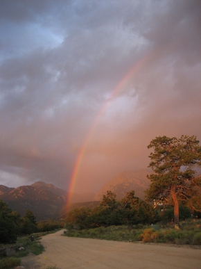
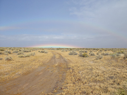
4th of July (2007) Double Rainbow
Taken by Wayne Clark out at the Ranchetts, looking SE towards
the Baca Grande.
- Next, tree struck by lighting
-
(Both photos by Keno)
|
|
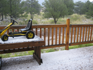
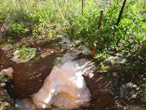
- We see a lot of hail storms here in Crestone -
|
|
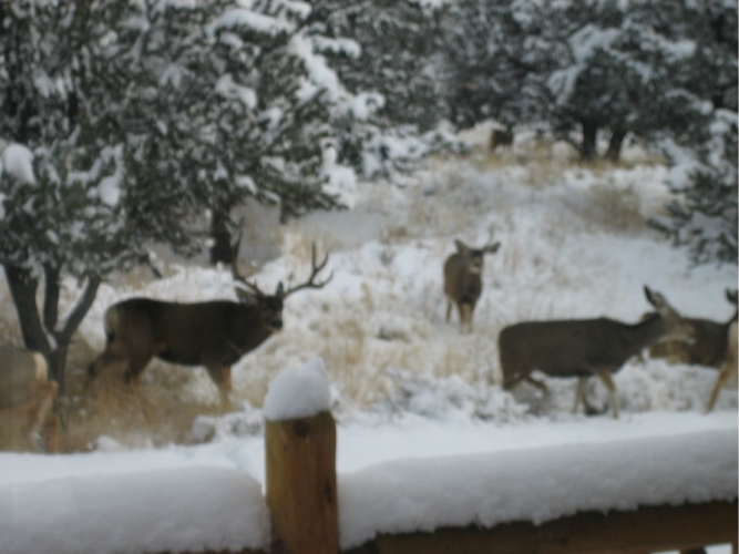
(http://www.youtube.com/watch?v=BE_1VoPDIF0) - Crestone Deer in the Snow -
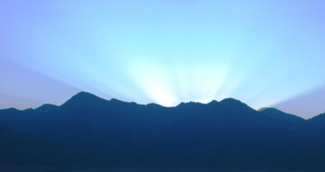
- Next, one sunrise, one sunset - |
|
|
|
|
|
(This photo and the next one by Fred Farrell) |
|
Freezing Fog Hangin' low out in the Valley
(January 18, 2009)
(Photo taken from our weather tower in Chalet 1 by Keno)
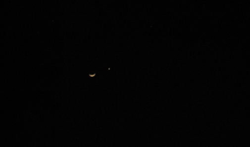
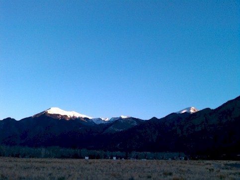
Clear skies, Moon and Venus Over Crestone
(February
27, 2009)
The skies here in Crestone are among the darkest and clearest skies
anywhere in the USA. (Photo by Keno)
- Easter Sunday Snowstorm -
April 12, 2009
The two photos below were taken as this
snowstorm, which produced 28.6" of snow, was taking place. 30 other excellent photos
of this storm were sent in to me by locals, and they can be found on a special photo page
I set up by clicking on
Easter Snowstorm.
|
|
- April 17, 2009 Snowstorm -
The second snowstorm to hit Crestone in five days brings in another 18+ inches before it ends the next day.
|
|
- Snow avalanching off our roof during the storm -
|
|
- Dragon Cloud -
Under the mountain some locals call Dragon Mountain, July 26, 2009
Others
might call this a lizard or snake cloud.
(Photo
taken from Casita Park by Kelly Hart)
Okay, so what is this
strange
phenomenon?
This is a very rare kind of double rainbow, that some call a "low bow". You can see the faint "normal" rainbow on the top, and the phenomenon near the horizon, well, it's a rainbow that is half on the ground - very rare indeed! This kind of a rainbow can only take place with the right condiations, either at or within one hour of high noon. This picture was taken on the Baca Ranch near the Great Sand Dunes National Park (looking north) just after 11 am, on October 7, 2009 by Larry "Animal" Garner. Had this happened right at noon, the rainbow would had been totally on the ground.
Sunrise, Thanksgiving morning,
2010
-9°F with 4" of snow on the ground.
(This photo sent in by
Tom "Tee" Burton)
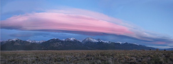
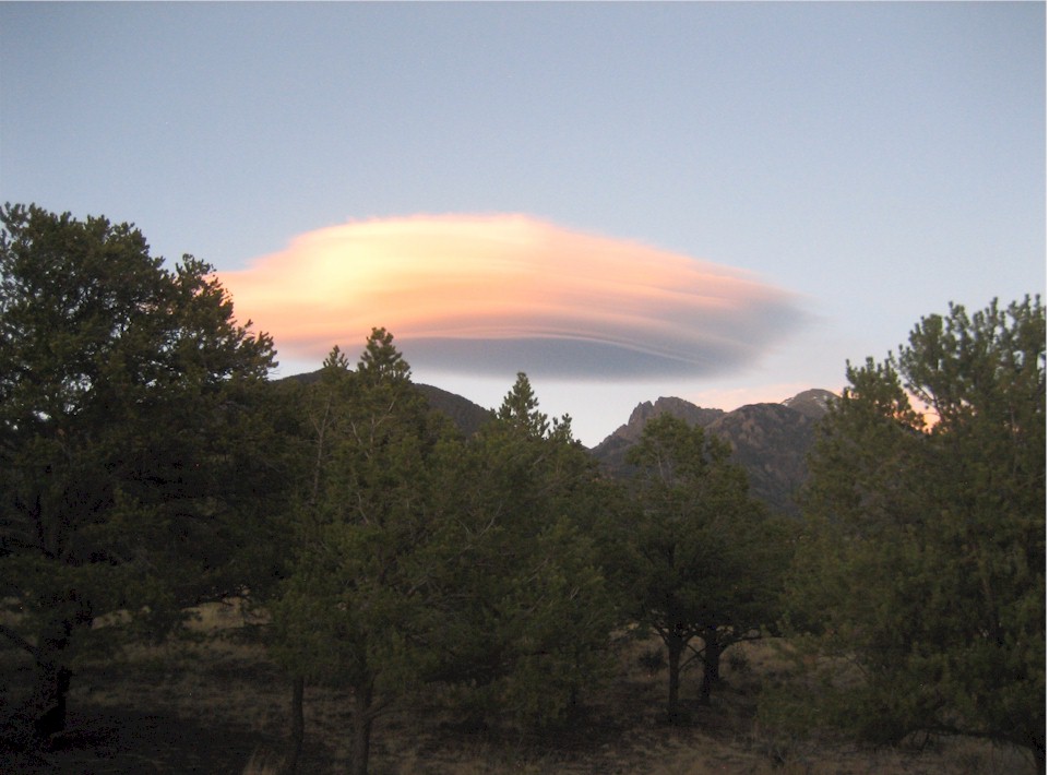
Flying saucer cloud over our mountains
Officially called a lenticular cloud, this photo was taken on December
8, 2010
(These 2 photos
[![]() above and below
above and below![]() ] were taken by
Kelly Hart)
] were taken by
Kelly Hart)
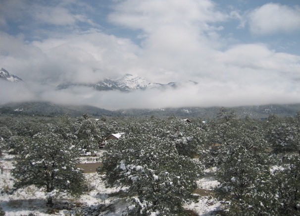
Snowdunes
The Great Sand Dunes National Park, Crestone's next-door
neighbor to the south, after a light snow, April 7, 2011
- October 8, 2011 Snowstorm -
It didn't really seem like a "storm", as there was almost no wind blowing most of the time, and most of the snow fell in the early morning hours before town residents started their days and missed seeing the heaviest of the snow fall. Still, the 9.5" in Baca 1 was a record snowfall for the day.
 Samten Ling Retreat Center Above Pyramid Point, 1 mile from the end of Summit View Way.The elevation is exactly 9000 feet. 15" of snow fell here. |
 Camino Baca Grande Road The Baca's main road is deserted at noon as the snow is coming to an end and the skies are clearing, but the view of the mountains are still obscured by fog. (Photo on the left sent in by Kelly Smith. Above photo by Keno) |
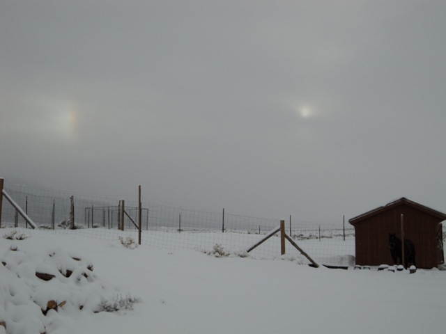
Phantom Sun over the Grants/Crestone sky
On the left is a sundog, aka "a
phantom sun", and officially called a "perihelion". Sundogs are formed by ice
crystals aloft. Photo taken on December 6, 2011 by Buddhist monk Tenzin
Yeshe at Tara Gonpa, near the Ziggurat.
|
|
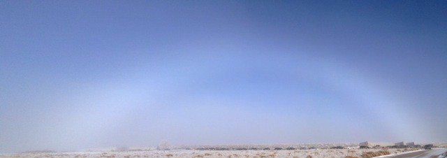
Cool White Rainbow (aka Fogbow)
Photo taken on December 27, 2012, out in the valley, west of Crestone, near the
POA building.
(This photo sent in by
Mark Talbot)
- Now a Mirage as seen from Casita Park! (2 photos) -
(1) This first
photo is of the mirage, looking east from Casita Park, taken on January 20,
2013, at 808am
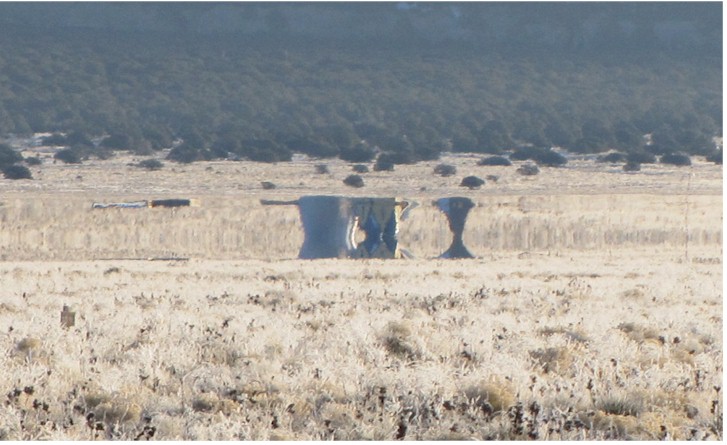
(2) This second photo below, was taken about 15 minutes later as the mirage faded; you can see the actual buildings now, one of which is a dome.
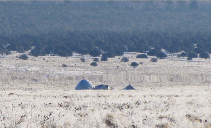
Both photos taken by Kelly Hart
(If you would like to read up on how mirages form,
check out this old
Eagle article I wrote back in 2003. The article is about a Fata Morgana
mirage, which is a bit different than this one above since a Fata Morgana mirage
can only be seen on the horizon, but it's formed in the same matter)
- Dust Devil out in the valley -
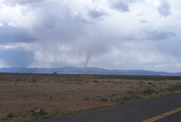
On late Thursday afternoon, May 16, 2013, this dust devil was spotted from Moffat and appeared to be on the ground near US Hwy 285 and County Road T (south of Saguache, Colorado), for around 20 minutes. The part hitting the ground looks more like a tornado, but its top looks like a classic dust devil. The National Weather Service in Pueblo has declared this to be a very large dust devil. Although the San Luis Valley sees a lot of dust devils in the spring, they are usually nowhere near this tall. Dust devils usually average around 30 or so feet high in the valley, but it isn't unusual to see taller ones of around 100 feet from time to time. But rarely in the valley are they as tall as this one. Very large dust devils of around 300 feet high do occur from time to time in some areas, and in a few in places like in the Middle East, they have been reported as tall as 3,000 feet. This photo was taken by David Chubirka.
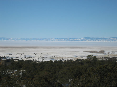
- Smoke from West Fork Fire invades the greater Crestone area -
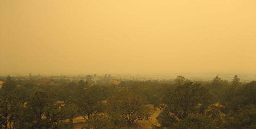
Looking out into the San Luis Valley, but the valley is gone, well, it's lost in the smoke!
For four afternoons and early evenings in a row - from June 19-22,
2013, smoke from wildfires burning across the valley in the San Juan Mountains
near Wolf Creek Pass, sent smoke into our area, bringing the visibility down to
less than 200 feet at times. Below are 3 more photos.
(Photo
above taken from our weather tower in Chalet 1 on June 20 by Keno. Photo below to the left
taken on June 22 by Michael Scully just before smoke hit town,
middle photo below taken by Kelly Smith on June 21 and is looking west, and photo
below on right taken on June 19 by Keno, looking east)
- Click on thumbnails for a larger view -
Pyrocumulus cloud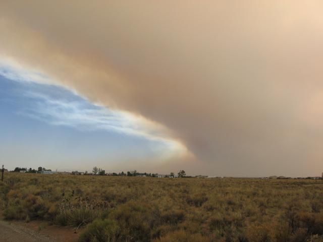 As seen from Casita Park |
Ridge above Pyramid Point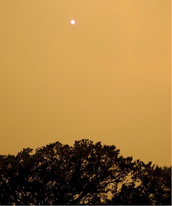 Town of Crestone, below, is gone! |
Smoky Crestone Mountains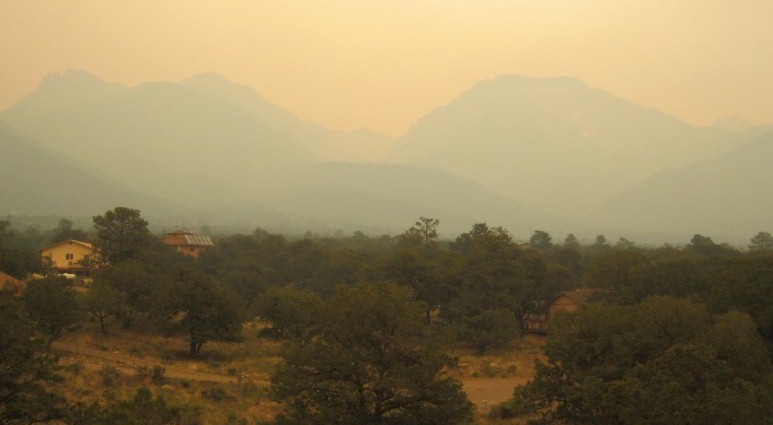 5 minutes later there was no view at all |
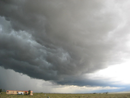
- Wall Cloud Approaches the Crestone Baca -
This wall cloud out over the valley is about to hit the Crestone Baca on Sunday afternoon, September 22, 2013. With it came damaging winds and large hail of up to one inch in some parts of the Baca. Most of the damage occurred out by the retreat centers located around 10,000 feet, with the biggest hail being reported around upper Chalet 1. This photo was taken by Dave Miller in Chalet 1, looking southwest. Below is a another wider shot of the same wall cloud.
- Click on thumbnail for a larger view -
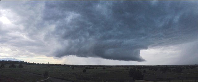
(This
photo by Noreen McCracken)
- Sun Halo -
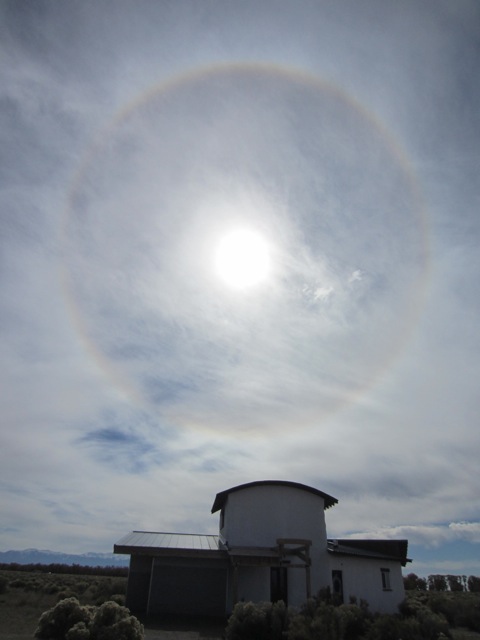
AKA a
"Sun Ring", this optical phenomenon, just like sundogs, are produced by ice crystals
aloft. This photo was taken on October 24, 2013, in the southwest corner of the
Grants by Ryan Wiedemann.
|
|
Hail Storm about to hit Crestone Chalet 1 -
May 6, 2015
This photo was taken by my grandson about
5 minutes before the first hail storm of 2015 was about to hit the Baca.
(This photo taken by
Cooper Goodhart)
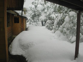
- Next 4 photos from the 18.3 inch snowstorm that hit on May 8, 2015 -

Looking north at Baca Chalet 1 from our weather tower after the storm ended
(photo taken by Keno)
|
|
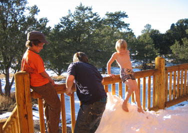
Buddha lends a helptng hand in clearing the snow out in the Grants
(photo sent in by Tenzin Yeshe)
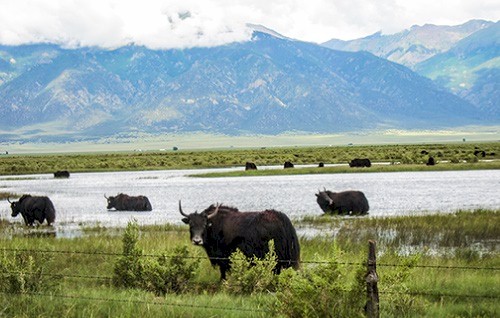
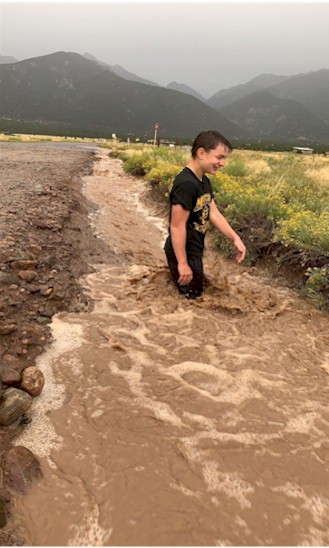
Yak in flood waters off of T-Road, July 2015
It's normal to see the
valley floor outside of Crestone flood each spring from the snowmelt/runoff, but
not in July!
(This photo sent in by
Noreen McCracken)
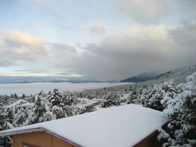
Samten Ling
Retreat
After about 16"
of snow fell on April 30, 2016
(Photo sent in by
Kelly Smith)
A rare Kelvin-Helmholtz
cloud formation over Mt. Blanca, on August 5, 2016
(photo sent in by Philip Tarlow)
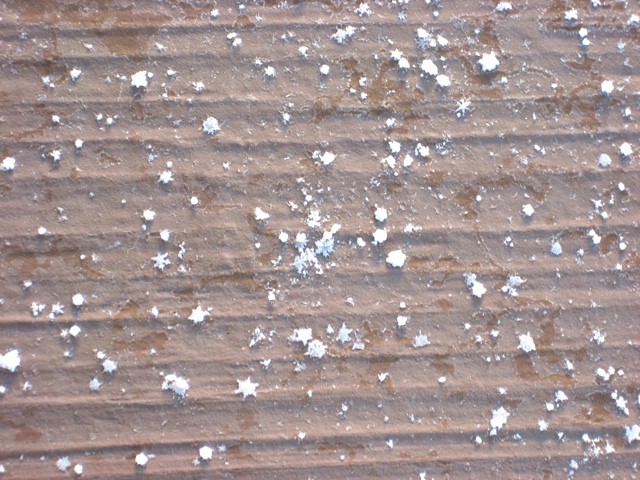
Snow pellets, including some that are star shaped, which fell on this
deck in Chalet 2,
on February 20, 2017
(photo sent in by Sandy Villa)
Fog covers the San Luis Valley after about 3 inches of May snow
falls on the Crestone foothills
(photo taken in
Chalet 2 by Jose Villa on May 10, 2017)
That's not snow, but 2" of hail on the ground after a hailstorm
hit Crestone on June 6, 2020
(photo taken in
Chalet 1 by Keno)
- Next, June snowfall in Crestone. Just 3 days after the above hail picture was taken -
|
|
- Early September Snowstorm photos next -
Just 91 days after the June 9, 2020 snowfall ended the 2019-20 snow season, the new 2020-21 season got started on September 8 with between 7 to 12 inches of snow falling in the greater Crestone/Baca area in a three day period.
Chalet 1 after 8.5 inches of snow
fell from September 8 till September10
(Photo taken at the Crestone Weather
Tower by
Keno)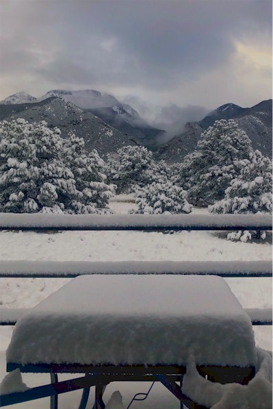
Chalet 2. From 8 to 12 inches of
snow was reported in this area after the storm ended
(This photo taken in Chalet 2 by Philip Tarlow)
|
|
A flying saucer cloud (officially
called a Lenticular cloud) over Crestone's
mountains, that formed on a windy spring day on May 6, 2022.
(Photo taken by Keno in Baca's Chalet 1)
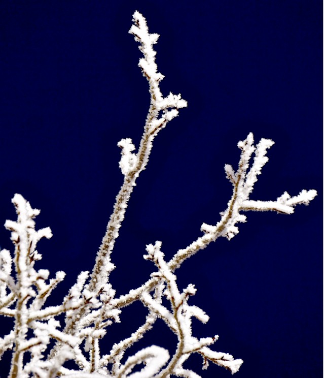
This isn't snow on this tree, but hoartfrost
(Photo taken in the morning on January 24, 2023 by Jananne Settle)
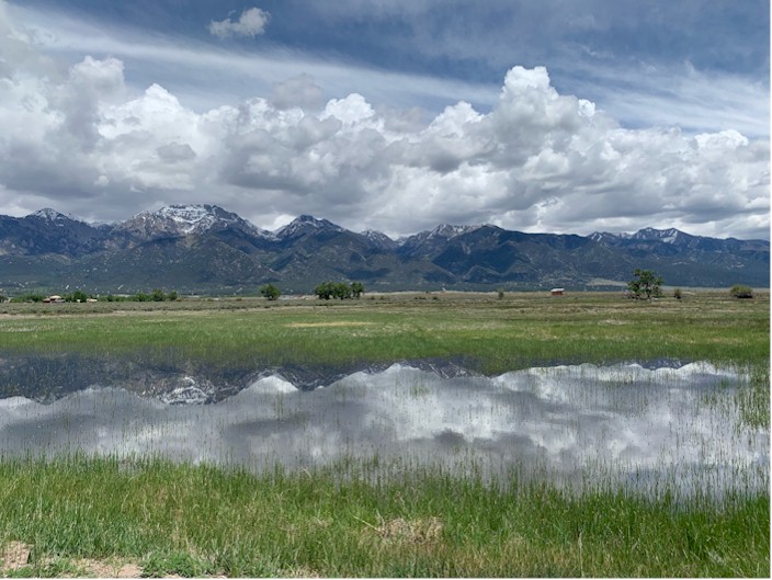
A nice reflection in the flood waters taken after a heavy rainfall on
June 5, 2023, out in the Grants at
Del Rey and Homestead
(Photo sent in by
Kirsten Schreiber)
- Next, 2 non-weather photos taken of 2 events over the Baca skies, just 11 days apart -

Northern Lights over Crestone and the Sangre de Cristo Mountains
As
seen from Moffat on October 10, 2024.
(The photos
![]() above and below
above and below![]() were taken by Cooper Goodhart)
were taken by Cooper Goodhart)

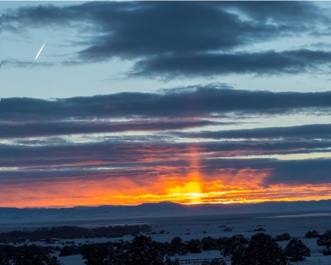
Comet Tsuchinshan-ATLAS
As seen from the Crestone-Baca
Weather Tower, looking west, on Oct 21, 2024.

Another Lenticular cloud, seen in the foothills by La
Veta Pass
This one looks like a spinning top! Taken on April 1,
2025)
(This photo by Jackie Goodhart)
- Crestone Flash Flood Photos | Easter 2009 Snowstorm Photos | November 2013 Snowstorm Photos -
| Current Crestone Weather | Crestone Snowfall Data Logs |
| Crestone Weather Records | USA & World Weather Records |
Copyright © 2001 - 2025 by Keno Internet Services, except where otherwise noted. All rights reserved.