
La Veta Pass
(US Hwy 160, traffic furthest to cam is traveling west)
Colorado Web Cams
North La Veta Pass, Colorado / La Veta, Colorado
(Note: This page may need reloading on some browsers for new views)
- First cams are from North La Veta Pass -
North La Veta Pass has an elevation of 9,413 feet (2,869 meters) and today is the principal highway route through this part of the Sangre de Cristo Mountain range, via U.S. Highway 160. This pass lies 1.6 miles northeast of Old La Veta Pass (elevation 9,380 ft. [2,860 m]), which years ago was the original, main travel route in the area. There is also a third close by pass, Veta Pass, elevation 9,220 feet (2,810 meter), to the southeast of Old La Veta Pass.
Located in south central Colorado, on the boundary between Huerfano and Costilla counties, North La Veta Pass is the primary link between the Colorado eastern Great Plains and the San Luis Valley. US 160 covers a 48-mile (77.24 km) stretch on the pass, running west-east, starting just outside and to the east of Fort Garland (in Costilla County) to the western outskirts of the City of Walsenburg (the county seat of Huerfano County).
Many years ago, long before European settlers arrived here, La Veta Pass served as a gathering point for many Native American tribes including the Ute, Navajo, and Cheyenne tribes. Throughout the 1800’s the pass became popular among trappers and miners exploring the territory. In 1877, the high elevation Rio Grande Railroad was completed and in turn, brought many tourists and businessmen over the pass. A small community even developed in the area for a time, though all the buildings there were destroyed by fire. In 1962, US Highway 160 was officially opened over the pass, traversing the new “North La Veta Pass”, and today this paved road serves as the main vehicular route through the area.
The La Veta Pass Automated Weather Observing System (AWOS) is located at the top of La Veta Pass, 4 miles south of Highway 160, sitting at 10,216 feet (3,114 meters). The pass features a severe alpine-influenced climate with long, freezing, and snowy winters alongside cool, comfortable summers. Temperatures typically range from 17 to 75 annually, rarely dropping to or below zero (°F). The area is windy, and often sees heavy snows, especially in the spring. It sees a total annual snowfall averaging 100.3 inches (255 cm) and experiences snow for up to 8 months, generally starting in October and lasting until May, based on climate data from its weather station.
La Veta Pass
(US Hwy 160, traffic furthest to cam is traveling west)

La Veta Pass
(US
Hwy 160)
The next 4 cans have been removed by CDOT!
Call and ask them to return these
cams asap!
The main customer service number for CDOT is (303) 757-9011

1.8 mi East of La Veta Pass (on US Hwy 160, traveling
east)

1.8 mi East of La Veta Pass
(on US Hwy 160, looking west)

2.1 mi East of La Veta Pass (on US Hwy 160, traveling
east)

2.1 mi East of La Veta Pass
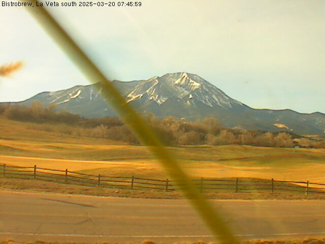
- Next, 2 web cams from the town of La Veta -
The Town of La Veta is in Huerfano County, Colorado, and is a charming small town nestled in the foothills of Southern Colorado, that sits at 7,037 feet (2,145 meters) at the base of the Spanish Peaks on the Highway of Legends National Scenic Byway. The town's population was 862 as of the 2020 United States Census. "Veta", means "mineral vein" in Spanish, and the town and the three nearby passes were named after a mineral deposit nearby.
According to the United States Census Bureau, this small town has a total area of 1.37 square miles (3.5 km2), all of it land. There are sulfur springs in the La Veta area, located at the historical Sulphur Springs Guest Ranch. The town was originally a busy trading center, supplying the nearby area with goods. It is now home to a diverse population of artists and ranchers. Nine historic buildings remain in the former thriving timbering community, including the 1877 train depot (today a museum), dance hall, tavern and old chapel.
Highest temperature ever in La Veta was 97°F (36°C ), and the coldest reading was −25°F (−32°C), reached in January. While many climate summaries for the area list these records, the specifically documented date for their occurrence is unavailable in historical climate summaries, and are not explicitly specified in any general records. This tells me that these records were taken and the events must have taken place decades ago.
FYI, the town of La Veta, is approximately 10 to 15 miles from the three passes noted on this page, North La Veta Pass, Old La Veta Pass, and Veta Pass.
To learn more on this cool town, visit this website for some very useful information: Undercover Colorado.
Hwy 12, looking south towards Cuchara and Spanish Peaks, La Veta, Co
CDOT has also removed this webcam, too, use the phone # noted above to protest this loss!

CO 12 , leaving La Veta, Co: Looking West
- Map of La Veta Pass -
| Colorado Web Cams | Cuchara | Fort Garland | Crestone Weather Center |