Worldwide Webcams
- United States Webcams -
(Note: This page may need reloading on some browsers for new views)
The United States of America (USA or U.S.A.), commonly known as the United States (US or U.S.), America, or The States, is a country primarily located in North America. The U.S. has 50 states covering a vast section of North America, 48 contiguous states occupy the middle latitudes of the continent, while the United States includes the state of Alaska, at the northwestern extreme of North America, and the island state of Hawaii, in the mid-Pacific Ocean. The conterminous states are bounded on the north by Canada, on the east by the Atlantic Ocean, on the south by the Gulf of Mexico and Mexico, and on the west by the Pacific Ocean. The US is the fourth largest country in the world in area (after Russia, Canada, and China). The national capital is Washington, which is coextensive with the District of Columbia, the federal capital region created in 1790. The 48 contiguous states and the District of Columbia occupy a combined area of 3,119,885 square miles (8,080,470 km2).
The Appalachian Mountains are the highest mountains on the East Coast, yet their highest peaks are pale compared to the Rocky Mountain in the Western part of the country, where 58 peaks over 14,000 feet (4,300 meters) are found in Colorado alone. The Great Plains are in the middle of the US, and are a broad expanse of flatland. Most or all of the U.S. states of Kansas, Nebraska, North Dakota and South Dakota are in the Plains, along with parts of 8 other states. On the West Coast, The Sierra Nevada and Cascade mountain ranges run close to the Pacific coast. Both the lowest and highest points in the contiguous United States are in California, with the highest peak being Mount Whitney, at 14,505 feet (4,421 meters), while to the east, Colorado, in the Rockies and High Plains, is the highest state based on an average elevation of 6,800 feet (2,100 meters), yes, its the highest state overall counting all 50 states. Yet the state that takes the prize for having the 10 highest peaks in all 50 states, including the highest overall peak, is Alaska. Denali (its orinial name, but formerly known as Mount McKinley in the 20th century - and Trump can go to Hell for trying to rename it, good people ignore his childish nonsense), reaches all the way up to 20,310 feet (6,190 meters). The lowest spot in all 50 states is found in Death Valley California, at Badwater Basin, at −279 feet (−85 meters). Then all the way back east and across the country, Delaware has the lowest mean average elevation for any state, at just 60 feet (18 meters). Yet Florida, the second lowest state after Delaware, is considered the flattest US state, in part since it has no mountains while Delaware has several very small ones and its highest point is over 100 feet higher than Florida's highest hill.
While the total population of the United States is large by world standards, its overall population density is relatively low. The country embraces some of the world’s largest urban clusters as well as some of the most extensive areas that are almost devoid of habitation. The U.S. population is highly diverse, with a diversity that to a great degree has come from vast and sustained global immigration. Probably no other country has a wider range of racial, ethnic, and cultural types than does the U.S.A.
The U.S. Census Bureau reported 331,449,281 residents as of April 1, 2020, making the United States the third-most-populous country in the world, after China and India. California is the most populace state with 39 million people. While many languages are spoken in the United States, English is by far the most commonly spoken and written. Yet there is no official language at the federal level. However, most US States do make English their official language. Three states and four U.S. territories have recognized local or indigenous languages in addition to English, including Hawaii (Hawaiian), Alaska (twenty Native languages), and South Dakota (Sioux). In total, 169 Native American languages are spoken in the U. S. In the US territory of Puerto Rico, Spanish is not only the official language, but is more widely spoken than English.
The climate of the United States varies due to changes in latitude, and a range of geographic features, including mountains and deserts. Generally, on the mainland, the climate becomes warmer the farther south one travels, and drier when one heads farther west. A humid subtropical climate is found in the south, except in southern Florida, which has a tropical climate, along with Hawaii. A Mediterranean climate prevails along most of the California coast; a temperate climate from the Southern Plains and lower Midwest east to the Middle Atlantic states, and continental climate in northern areas (locations roughly above 40°N, the Northern Plains, Midwest, Great Lakes and New England). Higher-elevation areas of the Rocky Mountains, the Wasatch Range, Sierra Nevada, and Cascade Range see an alpine climate. Coastal areas of Oregon and Washington have an oceanic climate, and Alaska is largely dominated by a subarctic climate, but with a subpolar oceanic climate in the southeast (Alaska Panhandle), southwestern peninsula and Aleutian Islands, along with a polar climate in the north.
The highest temperature ever recorded in the States was at Death Valley California, famous for being the hottest place on earth and driest place in North America. The world record highest air temperature of 134°F (57°C) was recorded there at Furnace Creek on July 10, 1913. At the opposite end of the scale of the thermometer, the coldest recoded temperature was set in Alaska, at -80°F (-62°C) on Jan. 23, 1971, in Prospect Creek, north of Fairbanks.
Most snow in a season was 1,140 inches (95 feet) or 2,896 centimeters, recorded at Mount Baker Ski Area (4,200 feet elevation) in Washington State during the July 1, 1998, to June 30, 1999, snow season. FYI, yes, snow has fallen in all 50 States, while Florida has seen very little (mainly around the panhandle) and in Hawaii, where on its tallest peaks they actually do see snow a few times a year. All 50 states, plus DC, on average receives 26.8 inches / 68 centimeters of snow per year. As far as rainfall goes, amounts are the highest in Hawaii, where at Waialeale on Kauai,, they see approximately 460 inches (11,684 millimeters) of rain each year, making it one of the rainiest spots in the entire world.
The cams here are grouped by the State that they are located in and are listed below from starting in the East and finishing up in the West.
!Please remember to use each cam's pause/stop button (lower left of cam) when
you finish watching any streaming cam, to help save resources!
- Maine -
Maine, the north easternmost U.S. state, is located in the New England region of America. It is known for its rocky coastline, maritime history and nature areas. It borders New Hampshire to the west, the Gulf of Maine to the southeast, and the Canadian provinces of New Brunswick and Quebec to the northeast and northwest, respectively. Maine is the largest state in New England by total area, nearly larger than the combined area of the remaining five states. Yet of the 50 U.S. states, it's the 12th-smallest by area, the 9th-least populous, the 13th-least densely populated, and the most rural. Maine's capital is Augusta, and its most populous city is Portland. Maine's total population was 68,408, as of the 2020 census. The territory of Maine has been inhabited by Indigenous populations for thousands of years, after the glaciers retreated during the last ice age.
Admission of Maine as the 23rd state of the US occurred on March 15, 1820. Acadia National Park, near Bar Harbor, is the only national park in Maine and in all of New England.
Maine has a humid continental climate, with warm and sometimes humid summers, and long, cold and very snowy winters. Winters are especially severe in the northern and western parts of Maine, while coastal areas are moderated slightly by the Atlantic Ocean, resulting in marginally milder winters and cooler summers than inland regions. Daytime highs are generally in the 75–85°F (24–29°C) range throughout the state in July, with overnight lows in the high 50s°F (around 15°C). January temperatures range from highs near 30°F (−1°C) on the southern coast to overnight lows averaging below 0°F (−18 °C) in the far north. It's record high temperature is 105°F (41°C), set on on July 4 and again on July 10, 1911, both times in North Bridgton. The coldest its been was set at Big Black River on January 16, 2009 at −50°F (−46°C). Most snow on record for a snow season was in Washington County, with 200 inches of snow falling on Eastport for the 2014-2015 winter season.
Wood Island Lighthouse, Maine, United States
(From Wood Island Life Saving Station Association)
Wood Island Light is an active lighthouse on the eastern edge of Wood Island in Saco Bay, on the southern coast of Maine. The lighthouse is located at the end of the Saco River. This lighthouse is a 47-foot conical white tower of granite rubble. It's construction was started in 1808 (the same year it was opened, and it's the nation's eleventh-oldest lighthouse). It was automated in 1986. Wood Island lighthouse's height is 47 feet (14 meters) and range is 18 nautical miles (33 km; 21 mi). The 32-acre (12.9 hectare) island the lighthouse sits on experiences a temperate maritime climate with warm, comfortable summers and cold, windy winters. Average temperatures in summer and early fall range from the mid-60s to high 70s°F (21°C) and in winter and early springs sees temperatures drop into the teens and 20s°F (-7°C), with frequent gale-force winds, nor'easters, and occasional sleet or snow.

Jordan Pond, Acadia National Park, Maine
(from
National Park Service)
Acadia National Park is a 47,000-acre Atlantic coast recreation area with landscape that's marked by woodland, rocky beaches and glacier-scoured granite peaks such as Cadillac Mountain, the highest point sitting on the U.S’ East Coast, at 1,527 feet (465 meters), sitting on Mount Desert Island. Among the wildlife are moose, bear, whales and seabirds. The bayside town of Bar Harbor, with restaurants and shops, is a popular gateway.
The park was established on July 8, 1916, it's total area is 49,075 acres (198.60 km2); 861.46 acres (348.62 ha; 3.4862 km2) private (in 2017). The park includes about half of Mount Desert Island, part of Isle au Haut, the tip of the Schoodic Peninsula, and portions of sixteen smaller outlying islands. Acadia has a rich human history, dating back more than 10,000 years ago with the Wabanaki people. The 17th century brought fur traders and other European explorers.
The region is characterized by a large seasonal variation in temperature with warm to hot summers that are often humid, and cold to severely cold winters. The record high and low temperatures are 96°F (36°C) and −21°F (−29°C), respectively. Average annual precipitation in Bar Harbor is 55.54 inches (1411 mm). The annual average snowfall is 71.8 inches (182.1 cm).
- New Hampshire -
New Hampshire is a U.S. state in New England in the Northeastern part of the country. It borders Massachusetts to the south, Vermont to the west, Maine and the Gulf of Maine to the east, and the Canadian province of Quebec to the north. Of the 50 U.S. states, New Hampshire is the fifth smallest by area and the tenth least populous, with a population of 1,377,529 residents as of the 2020 census. Concord is the state capital and Manchester is the most populous city.
New Hampshire experiences a humid continental climate and a subarctic climate in some northern highland areas. It sees warm, humid summers, and long, cold, and snowy winters. Precipitation is fairly evenly distributed all year. January temperatures range from an average high of 34°F (1°C) on the coast to overnight lows below 0°F (−18°C) in the far north and at high elevations. Average annual precipitation statewide is roughly 40 inches (100 cm) with some variation occurring in the White Mountains due to differences in elevation and annual snowfall. New Hampshire's highest recorded temperature was 106°F (41°C) in Nashua on July 4, 1911, while the lowest recorded temperature was −47°F (−44°C) atop Mount Washington on January 29, 1934. Mount Washington also saw an unofficial −50°F (−46°C) reading on January 22, 1885, which, if made official, would tie the record low for New England.
New England, USA
(From
Boston and Maine Live)
New England Cam - from Mount Katahdin, Maine to Acadia National Park, Boston to Mystic, Connecticut - best of New England live cameras with Weather, Timelapse video and Relaxing Music. New England US contains the states of Maine, New Hampshire, Vermont, Massachusetts, Rhode Island and Connecticut.
Observatory Tower, Mount Washington, New Hampshire, U.S.A.
(From
Mount Washington
Observatory)
Mount Washington's elevation is 6,288 feet (1,917 meters) - the highest peak in the Northeastern United States, and the most topographically prominent mountain east of the Mississippi River.
The mountain is notorious for its erratic weather. On April 12, 1934, the Mount Washington Observatory recorded a wind speed of 231 miles per hour (372 km/h) at the summit, which was the world record from 1934 until 1996; but it still holds that record for the Northern Hemisphere and Western Hemisphere, along with the record for highest measured wind speed not associated with a tornado or tropical cyclone. The summit station of Mount Washington has an alpine climate and tundra climate. Elevations just beneath treeline have a subarctic climate which eventually transitions to a humid continental climate near the mountain's base.
Because of the high winds, the treeline here is very low, at only 4,400 feet (1,300 meters), as it's too hostile to support any plant life more than a few inches (centimeters) in height. You can compare that to the U.S. Rocky Mountains out west, where the treelines there are on average at around 11,000 feet (3,352.8 meters). Mount Washington's official record low is −47°F (−44°C), set on January 29, 1934. The annual snowfall is 281.2 inches (714 centimeters). The highest temperature recorded on Mount Washington's summit was 72°F (22.2°C), which occurred on August 2, 1975, and also on June 26, 2003.
First Connecticut Lake, Pittsburg, New Hampshire, USA
(from
Lopstick)
Located in New Hampshire's Great North Woods, Lopstick offers vacation cabin rentals in beautiful Pittsburg NH. First Connecticut Lake is located in the town of Pittsburg, 7 miles (11 km) northeast of the village center, along the headwaters of the Connecticut River. There are four lakes: First, Second, Third and Fourth Connecticut Lake, numerically running south to north. The lakes decrease in size and increase in elevation, sequentially from first to fourth. The fourth lake is the source of the Connecticut River.
-Vermont -
Vermont is a state in the northeastern United States, known for its natural landscape, which is primarily forested. Part of the New England region, it's also known for being home to more than 100 19th-century covered wooden bridges, scenic rolling mountains and as a major producer of maple syrup.
The state borders Massachusetts to the south, New Hampshire to the east, New York to the west, and the Canadian province of Quebec to the north. As of the 2020 U.S. census, the state had a population of 643,503, ranking it the second least populated U.S. state ahead of Wyoming. Vermont is one of two states with fewer people than the District of Columbia. It is the nation's sixth smallest state in area. The state's capital of Montpelier is the least populous U.S. state capital. Its total size is at 9,614 square miles (24,900 km2), making it the 45th-largest state. It is the only state that does not have any buildings taller than 124 feet (38 m). Land comprises 9,250 square miles (24,000 km2) and water comprises 365 square miles (950 km2), making it the 43rd-largest in land area and the 47th in water area. In total area, it's larger than El Salvador and smaller than Haiti. It is the only landlocked state in New England.
In the 21st century, Vermont increasingly became defined by its progressivism. It was the first state to introduce civil unions in 2000 and the first state to legalize same-sex marriage in 2009, unforced by court challenge or ruling. On January 22, 2018, Vermont became the first state to legalize cannabis for recreational use - by legislative action (that is, it was not passed by the people themselfs), and was the ninth state in the U.S. to legalize marijuana for medical purposes.
Vermont has a humid continental climate, with muddy springs, and in general, a mild early summer with hot Augusts. It has colorful autumns with gold foliage as cold weather approaches. The highest recorded temperature was 105°F (41°C), at Vernon, on July 4, 1911. Its lowest recorded temperature was −50°F (−46°C), at Bloomfield, on December 30, 1933. The state receives between 2,200 and 2,400 hours of sunshine annually.
Covered Bridge Webcam, Waitsfield,
Vermont, U.S.A.
(From
MadRiverValleyTV)
Waitsfield is a town in Washington County, Vermont. The population here was 1,844 as of the 2020 census. It's located in the heart of the Mad River Valley, surrounded by spectacular natural beauty, including the Green Mountains and the Mad River. The town has a total area of 26.9 square miles (69.7 km2) and sits at 800 feet. It sees a lot of snow each winter, with an average of 117.7 inches (299 cm) each snow season, and year round a good amount of rain, with its yearly average precipitation being 50.22 inches (1,275 cm).
Goodrich Memorial Library, Newport, Vermont, U.S.A.
(from
WCAX Skywatch 3)
Newport (elevation 686 feet / 209 meters) is the only "city" in Orleans County, Vermont. Newport as a settlement was founded in 1793, after the American Revolutionary War. As of the 2020 Census, the population was 4,455 (how can it be called a city with such few locals living there? I'll explain why in 2 sentences from here). It is the second-smallest city by population in Vermont and its total area is also real small, only 7.6 square miles (19.76 km2) - and 21% of that total is water. It should not be confused with the neighboring smaller town of Newport to its west (and yes, this is why the larger Newport is called a city, yet in most places, few such small towns are called cities; the U.S. Census Bureau classifies any incorporated community of under 5,000 residents simply as a "small town".) .
The climate in Newport is humid continental, characterized by short, comfortable summers and long, freezing, snowy winters. Temperatures typically range from an average low of 7°F
(-14°C) in the winter to a summer high of 77°F (25°C). The highest all-time temperature recorded
here is 98°F (37°C). This
took place on July 18, 1953. The coldest ever was -38°F (-39°C) that reading
was officially tied on February 14, 2016. It was first reached on January 15, 1957. Average snow per season
here is a lot, at 98.6 inches
(250 cm).
- Massachusetts -
Massachusetts, officially the Commonwealth of Massachusetts, is a state in the New England region of the Northeastern U.S. It borders the Atlantic Ocean and the Gulf of Maine to its east, Connecticut and Rhode Island to its south, New Hampshire and Vermont to its north, and New York to its west. Massachusetts takes its name from the Massachusett tribe of indigineous people, who lived in the Great Blue Hill region south of Boston.
Only four US states, including Massachusetts, designate themselves as commonwealths - the other three are Pennsylvania, Virginia, and Kentucky. No other states are commonwealths, yet there's no legal difference between these commonwealths and other states. In Massachusetts, it's believed that the word was used to show that the populace held some anti-monarchic sentiment among then towards England.
Massachusetts' land area totals 10,565 sq mi (27,363 km2), and this includes its waterways. Its average elevation is 508 feet (150 m), with it's highest point being Mount Greylock at 3,489 feet (1,063.4 m), while its lowest elevation is the Atlantic Ocean, at 0 feet (0 m).
Most of Massachusetts has a humid continental climate, with cold winters and warm summers. Far southeast coastal areas are the broad transition zone to Humid Subtropical climates. The warm to hot summers render the oceanic climate rare in this transition, only applying to exposed coastal areas such as on the peninsula of Barnstable County.
Boston, Massachusetts, USA
(from
Boston and Maine Live)
Live webcam showing the Boston’s skyline including view of the Charles River and Dam Bridge. Founded in 1630, Boston is the capital city and most populous city in the state of Massachusetts, and is known for its historical significance, cultural attractions and top universities. It has an area of 48.4 sq. mi (125 km2) and a population of 675,647 as of the 2020 census, making it the third-largest city in the Northeastern United States after New York City and Philadelphia. The larger Greater Boston metropolitan area had a population of 4.9 million as of 2023. It has an area of 89.63 sq. mi (232.1 km2).
Here's a few fun facts about Boston. It's famous nickname, "Beantown", comes from a love among the city’s earliest settlers for baked beans; The Ted Williams Tunnel is the deepest in America, approximately 90 feet underground; The Pilgrims believed Christmas was a corrupt holiday and banned it in the city between 1659 & 1681; The Boston Cream Pie was invented here, at the Omni Parker House and is the official dessert of the state; Boston built America’s first subway - The Tremont Street Subway, in 1897. Many of the city’s first settlers came from Boston, England and simply used the name for their new hometown.
Boston's climate has 2 different classification, a hot-summer humid continental climate and a humid subtropical climate. Fog is fairly common here, particularly in spring and early summer. Summers are warm to hot and humid, while winters are cold and stormy, with occasional periods of heavy snow. The hottest temperature ever seen in Boston was 104°F (40°C), set on July 4, 1911, while the city's coldest reading was set on February 9, 1934, at −18°F (−28°C.)
- Connecticut -
Connecticut is a U.S. state in southern New England that has a mix of coastal cities and rural areas dotted with small towns. Mystic is famed for its Seaport museum filled with centuries-old ships, and the beluga whale exhibits at Mystic Aquarium. On Long Island Sound, the city of New Haven is known as the home of Yale University and its acclaimed Peabody Museum of Natural History. Its capital is Hartford, and its most populous city is Bridgeport. Connecticut lies between the major hubs of New York City and Boston along the Northeast Corridor, where the New York metropolitan area, which includes four of Connecticut's seven largest cities, extends into the southwestern part of the state. Connecticut is the third-smallest state by area after Rhode Island and Delaware (Total area is 5,543 square miles / 14,356 km2), and the 29th-most populous with more than 3.6 million residents as of 2024, ranking it fourth among the most densely populated U.S. states.
Connecticut shares direct borders with three states: New York borders Connecticut to the west, Massachusetts borders it to the north, and Rhode Island: b orders the state to the east. The state is low to the ground, with an average elevation of 490 feet (150 meters), with its highest elevation on the Massachusetts border on south slope of Mount Frissell at 2,379 feet (725 meters) and its lowest location at Long Island Sound, at 0 feet (0 meters).
The name of this state, Connecticut, is derived from the Mohegan-Pequot word that has been translated as "long tidal river" and "upon the long river", both referring to the Connecticut River. Evidence of human presence in the Connecticut region dates to as far back as 10,000 years ago. Connecticut ratified the U.S. Constitution on January 9, 1788, becoming the fifth state.
Connecticut lies at the rough transition zone between the southern end of the humid continental climate and the northern portion of the humid subtropical climate. Northern Connecticut generally experiences a climate with hot, humid summers and moderately cold winters with periodic snowfall. Far southern and coastal Connecticut has a climate with cool winters with a mix of rain and infrequent snow, and the long hot and humid summers typical of the middle and lower East Coast. Coastal Connecticut is the very broad transition zone between the humid continental climate and the humid subtropical climate. Connecticut's record high temperature is 106°F (41°C) which occurred in Danbury on July 15, 1995. The lowest temperature recorded in Connecticut is -32°F (-36°C) which has been observed twice: in Falls Village on February 16, 1943, and in Coventry on January 22, 1961. The average yearly snowfall ranges from about 60 inches (152 cm) in the higher elevations of the northern portion of the state to only 20–25 inches (about 56 cm) along the southeast coast of Connecticut (Branford to Groton). Most of Connecticut has less than 60 days of snow cover, while coastal areas often only see 30 days or so of snow cover. Annually, 95% of seasonal snowfall in Connecticut falls from early December to late March.
Connecticut
(from
)
New London is a coastal Connecticut city. It is home to a population of 27.4k people (in 2020), and its total area is 138.61 square miles (359 km2), but the city itself is just 10.59 square miles (27.43 km2), while its elevation is 56 feet (17 meters). As you might have guessed, the city is name after London, England. It was first settled in 1646 as Pequot Plantation, renamed New London in 1658, and incorporated as a city in 1784.
Using the Köppen climate classification, New London has a warm temperate climate. It experiences long, hot and humid summers, and cool to cold winters with snowfall on occasion. Its highest ever temperature was 101°F (38°C), set in July, while the coldest reading was -14°F (-46°C). The city's average snowfall per season is below the nation's average (of 29 inches), at 24.5 inches (62 cm).
- New York State -
New York is a state in the northeastern U.S., known for New York City and the towering Niagara Falls. NYC’s island of Manhattan is home to the Empire State Building, Times Square and Central Park, among many other famous places. The iconic Statue of Liberty stands in New York Harbor. To the east, Long Island has wonderful white sandy beaches (on it's south shore); the Hamptons, Fire Island and the Montauk Lighthouse (on its eastern tip). Albany is the state's capital.
The state of New York covers a total area of 54,555 square miles (141,297 km2) and ranks as the 27th-largest state by size. The highest elevation in New York is Mount Marcy in Northern New York, at 5,344 feet (1,629 meters); while the state's lowest point is at sea level, on the Atlantic Ocean on Long Island's south shore. New York State is bordered by six other U.S. states: Connecticut, Massachusetts, Pennsylvania, Rhode Island, New Jersey and Vermont, and the Canadian provinces of Quebec and Ontario. Quebec forms New York's northern border and Ontario makes up New York's western water border. Pennsylvania and New Jersey borders New York to the south, while Connecticut, Massachusetts, Rhode Island and Vermont are to the east. Rhode Island has a water border with New York across Long Island Sound. New York has a varied geography.The southeastern part of the state, encompasses New York City, the United State's largest city; Long Island, the nation's most populous island; and the suburbs of the lower Hudson River Valley. These areas are the center of the New York metropolitan area, a sprawling urban landmass, and account for approximately two-thirds of the state's population. The much larger upstate area spreads from the Great Lakes to Lake Champlain and includes the Adirondack Mountains and the Catskill Mountains (part of the Appalachians). The east–west Mohawk River Valley bisects the more mountainous regions of upstate and flows into the north–south Hudson River valley near the state capital of Albany. Western New York, home to the cities of Buffalo and Rochester, are part of the Great Lakes region and borders Lake Ontario and Lake Erie, where it borders the Canadian provinces of Ontario and Quebec to the north. The border between New York and Ontario is marked by the Niagara River, which flows from Lake Erie to Lake Ontario. Central New York is anchored by the city of Syracuse; between the central and western parts of the state, the region is dominated by the Finger Lakes, a popular tourist destination. To the south, along the state border with Pennsylvania, the Southern Tier sits atop the Allegheny Plateau.
New York was the most populous state in the US from the 1810s until 1962. As of 2023, it is the nation's fourth-most populous state, with 19,571,216 people, 92% of its residents live in an urban area, predominantly in the New York City metropolitan area. According to the 2000 census, Italian, Irish, German, African American and English were the most common ancestries. In 2019, the U.S. Census reported that 69.5% of New York's population only spoke English, with 30.6% speaking a language other than English. Spanish remained the second most spoken non-English language.
Most of New York has a humid continental climate, though New York City and Long Island have a humid subtropical climate. Downstate New York (comprising NYC, LI, and lower portions of the Hudson Valley) have hot summers with high humidity, with cold, damp winters which are relatively mild compared to temperatures upstate, due to the downstate region's lower elevation, proximity to the Atlantic Ocean, and relatively lower latitude. Upstate New York experiences warm summers, marred by brief intervals of sultry conditions, with long and cold winters. Western New York, particularly the Great Lakes region, receives heavy lake-effect snows, especially during the earlier portions of winter, before the surface of Lake Ontario itself is covered by ice. New York State's record-high temperature is 108°F (42.2°C), reached on July 22, 1926, in Albany. Its record-low temperature is −52°F (−46.7°C) on February 18, 1979 at Old Forge. Most snow in a snow season was 466.7 inches / 1,185 centimeters, set in Hooker (near Lake Ontario) in the winter of 1976-77.
Tobay Beach, Long Island, New York, USA
(From the
Town of
Oyster Bay)
Long Island (sometimes called "the Island" by locals) is an expansive, densely populated island in southeastern New York State, stretching east from New York City. Along its Atlantic coast are Jones Beach, Fire Island and Montauk, the latter home to the the fourth-oldest working lighthouse in the nation, Montauk Point Lighthouse, built in 1792, and still in service. Its population was 8,063,232 residents as of the 2020 U.S. census, which is 40% of New York State's entire population. It's the most populous island in any U.S. state or territory, the third-most populous island in the Americas after Hispaniola and Cuba, and the 18th-most populous island in the world. Overall, the Island stretches 118 miles/190 kilometers long (east-west), 23 miles/37 kilometers at its widest point (north-south) and is bordered by the Atlantic Ocean to the south, Long Island Sound to the north, the East River to the west, and Block Island Sound to the east. Its total area is 1,401 mi²/3629 km².
Long Island's winter temperatures are milder than most
of the state. The warmer temperatures are due to its coastal location, with the
Island’s warmest temperature ever being 104°F/40°C, set on July 3, 1966. Winter
temperatures are milder than most of the state, with the lowest temperature ever
recorded at -23°F (-31°C) on January 22, 1961 at Islip. Long Island's average
snowfall per year is 32.6 inches / 82 cm.
For the above webcam at Tobay Beach, the beach is located just 4 miles east of historic Jones Beach on Ocean Parkway, located in the middle of Jones Beach Island, a barrier island off the South Shore of Long Island. “Tobay” is a portmanteau for the Town of Oyster Bay, which owns and manages the beach. Sadly, in 2020, it became a restricted access beach. Residents of the town are allowed entry, with limited access for non-residents. But getting back to the webcam, the view when it's looking east southeast, shows in the distance the western tip of Fire Island, it's lighthouse, water tower and the Great South Bay Bridge that leads to it. (Map and more beach views are here)
Times Square, New York City, New York, USA
(From
AE Signage)
New York City or NYC (called "The City" by locals), is the most populous city in the U.S. Located at the southern tip of New York State on one of the world's largest natural harbors, the city comprises five boroughs, each coextensive with a respective county. Four of its five boroughs are situated on three islands at the mouth of the Hudson River: Manhattan Island; Staten Island; and Long Island, which contains Brooklyn and Queens at its western end. With an estimated population in 2023 of 8,258,035 distributed over 300.5 square miles (778.2 km2), the city is the most densely populated major city in the States. New York City has more than double the population of Los Angeles, the nation's second-most populous city. With more than 20.1 million people in its metropolitan area and 23.5 million in its combined statistical area as of 2020, NYC is one of the world's most populous megacities. Two-thirds of the New York State's population resides in the New York metropolitan area.
New York City is a global center of finance and commerce, culture, technology, entertainment and media, academics and scientific output, the arts and fashion, and, as home to the headquarters of the United Nations. It is sometimes described as the world's most important city.
It's climate classifications is humid subtropical. The city receives an average of 49.5 inches (1,260 mm) of precipitation annually, which is relatively evenly spread throughout the year. Winters are chilly and damp, and NYC averages 29.8 inches (75.7 cm) of snow per year. Yet the Atlantic Ocean and the partial shielding from colder air by the Appalachian Mountains, keeps the city warmer in the winter than inland North American cities at similar or lesser latitudes. The daily mean temperature in January, the area's coldest month, is 33.3°F (0.7°C). Temperatures can drop at night to 10°F (−12°C) a few times per winter. Summers are typically hot and humid, with a daily mean temperature of 77.5°F (25.3°C) in July. The highest temperature ever observed in Central Park, where its official weather station is located, was 106°F (41°C) on July 9, 1936 (although LaGuardia Airport unofficially reported 107°F (42°C) on July 3, 1966). The lowest ever temp recorded is -15 °F (-26 °C) on February 9, 1934.
New York City has been described as the gay capital of the world and the central node of the lesbian, gay, bisexual, and transgender (LGBT) socio-ecological systems, and is home to one of the world's largest LGBT populations, with about 570,000 self-identifying gay and bisexual people, the largest in the United States.
Times Square is a major commercial intersection, tourist destination, entertainment hub, and neighborhood in the Midtown Manhattan section of New York City. It is formed by the junction of Broadway, Seventh Avenue, and 42nd Street. Together with adjacent Duffy Square, Times Square is a bowtie-shaped plaza five blocks long between 42nd and 47th Streets. Times Square is brightly lit by numerous digital billboards and advertisements as well as businesses offering 24/7 service. One of the world's busiest pedestrian areas, it is also the hub of the Broadway Theater District and a major center of the world's entertainment industry. Times Square is one of the world's most visited tourist attractions, drawing an estimated 50 million visitors annually. Approximately 330,000 people pass through Times Square daily. Times Square is also the site of the annual New Year's Eve ball drop. About one million revelers crowd Times Square for the New Year's Eve celebrations, more than twice the usual number of visitors the area usually receives daily.
New York City Lower Manhattan & New York Harbor,
New York, USA
(This cam from
St. George Tower)
The New York City Skyline is like no other city's skyline. While I've been
living in the Rockies my entire adult life, I grew-up in this city and I've
seen most of the city skylines in America, Canada, and several in Mexico,
but this one in NYC beats them all - looking from the Long Island side,
anyway! (Map and more NYC street views are here: NYC Map.
Niagara Falls, New York USA and Ontario, Canada
(From
https://www.niagarafallslive.com)
Niagara Falls is a group of three waterfalls at the southern end of Niagara Gorge, spanning the border between the province of Ontario in Canada and the state of New York in the United States. The largest of the three is Horseshoe Falls (the most powerful waterfall in North America, and also known as the Canadian Falls), which straddles the international border of the two countries. The smaller American Falls and Bridal Veil Falls lie within the United States. Bridal Veil Falls is separated from Horseshoe Falls by Goat Island and from American Falls by Luna Island, with both islands situated in New York. Formed by the Niagara River, which drains Lake Erie into Lake Ontario, the combined falls have the highest flow rate of any waterfall in North America that has a vertical drop of more than 160 ft. (50 m). The cam's view is from the U.S. side of the falls. Niagara Falls Map
- You can checkout a lot more New York State Webcams (from over 200 locations in the state) at my New York Webcams site -
- New Jersey -
New Jersey is a northeastern U.S. state with some 130 miles of Atlantic coast. The Jersey Shore includes notable resort towns like historic Asbury Park and Cape May, with its preserved Victorian buildings. It's the third oldest U.S. States, admitted to the Union on December 18, 1787. It's average elevation sits low, at 250 feet (80 meters). Located at the geographic hub of the heavily urbanized Northeast megalopolis, it is bordered to the northwest, north, and northeast by New York State; on its east, southeast, and south by the Atlantic Ocean; on its west by the Delaware River and Pennsylvania; and on its southwest by Delaware Bay and Delaware. At 7,354 square miles (19,050 km2), it is the fifth-smallest state in land area. According to a 2024 U.S. Census Bureau estimate, it is the 11th-most populous state, with over 9.5 million residents (in 2024), its highest estimated count ever.
The state consists of two climate zones; most of it has a humid subtropical climate, while the northwest has a humid continental climate. Summers are typically hot and humid, with temperatures exceeding 90°F (32°C) on average 25 days each summer, and exceeding 100°F (38°C) in some years. Winters are usually cold. All-time temperature extremes recorded in here include a very hot 110°F (43°C) on July 10, 1936, in Runyon, and a very cold −34°F (−37°C) on January 5, 1904, in River Vale. Average annual precipitation ranges from 43 to 51 inches (1,100 to 1,300 mm), spread uniformly throughout the year. Average snowfall per winter season varies from 10–15 inches (25–38 cm) in the south and near the seacoast, 15–30 inches (38–76 cm) in the northeast and central part of the state, to about 40–50 inches (1.0–1.3 m) in the northwestern highlands, but like all places in the eastern half of America, this often varies considerably from year to year.
Atlantic City, New Jersey
(From
Resorts Casino Hotel)
Atlantic City is a resort city on New Jersey's Atlantic coast that's known for its many casinos, wide beaches and iconic Boardwalk. Established in the 1800s as a health resort, today the city is dotted with glitzy high-rise hotels and nightclubs. In addition to gambling at slot machines and table games, the casinos offer spa treatments, performances by famous comedy and music acts, and high-end shopping. The city is located 60 miles (97 km) southeast of Philadelphia and 125 miles (201 km) south of New York City.
Located in South Jersey on Absecon Island, the city is prominently known as the "Las Vegas of the East Coast" and inspired the U.S. version of the board game Monopoly, which uses various Atlantic City street names and destinations in the game. As of the 2020 census, the city had a population of 38,497, a decline of 1,061 (−2.7%) from the 2010 census count of 39,558, which in turn reflected a decrease of 959 (−2.4%) from the 40,517 counted in the 2000 census. But declining population has happen here before, and in modern times, by the late 1970s, the then dying resort city, in an effort at revitalizing the city, conviniced New Jersey voters in 1976 to pass a referendum, approving casino gambling for Atlantic City. Immediately after the legislation passed, the owners of the Chalfonte-Haddon Hall Hotel began converting it into the Resorts International. It was the first legal casino in the eastern United States when it opened on May 26, 1978. Today they also host the above webcam that we get to view.
Atlantic City has a humid subtropical climate with warm, humid summers, cool winters and year-around precipitation. During the summer months in Atlantic City, a cooling afternoon sea breeze is present on most days, but episodes of extreme heat and humidity occur with heat index values at or above 100.0°F (38.0°C). During the winter months, episodes of extreme cold and wind can occur with wind chill values below 0.0°F (−17.8°C). The average seasonal (November–April) snowfall total is 12 to 18 inches (300 to 460 mm), and the average snowiest month is February which corresponds with the annual peak in nor'easter activity. Temperature wise, the hottest temperature ever recorded in Atlantic City was 106°F (41°C) on June 28, 1969, while the coldest temperature ever recorded was 9°F (-12.7°C) . This occurred on February 9, 1934.
- Pennsylvania -
Pennsylvania, officially the Commonwealth of Pennsylvania, is a state spanning the Mid-Atlantic, Northeastern, Appalachian, and Great Lakes regions of the U.S. It borders Delaware to its southeast, Maryland to its south, West Virginia to its southwest, Ohio and the Ohio River to its west, Lake Erie and New York to its north, the Delaware River and New Jersey to its east, and the Canadian province of Ontario to its northwest via Lake Erie. It's one of the oldest U.S. States, admitted to the Union on December 12, 1787, making it the second State. Before that, between 1638 and 1655, a southeast portion of the state was part of New Sweden, a Swedish colony. Established as a haven for religious and political tolerance, the colonial-era Province of Pennsylvania was known for its relatively peaceful relations with native tribes, innovative government system, and religious pluralism. Pennsylvania was then founded in 1681 through a royal land grant to William Penn, the son of the state's namesake.
Pennsylvania's diverse topography produces a variety of climates, though the entire state experiences cool to cold winters and very warm, humid summers. Straddling two major zones, much of the state has a humid continental climate. The southern portion of the state has a humid subtropical climate. Summers are generally hot and humid. Moving toward the mountainous interior of the state, the winter climate is colder, the number of cloudy days increases, and snowfall amounts are greater. Western areas of the state, particularly locations near Lake Erie, can receive over 100 inches (250 cm) of snowfall annually, and the entire state receives plentiful precipitation throughout the year. The state sometimes is subject to severe weather from spring through summer into autumn. Tornadoes occur annually in the state, sometimes in large numbers; violent tornadoes, however, are rarer than they are in states further west.
Susquehanna River, Pennsylvania
(From Susquehanna River Basin Commission)
Live stream of the Susquehanna River from the Susquehanna River Basin Commission (SRBC) Headquarters in Harrisburg, PA. The camera faces northwest, offering an upstream view of the river and the historic Rockville Bridge—one of the longest stone arch railroad bridges in the world.
From its origin at Otsego Lake in Cooperstown, New York, the Susquehanna River flows for 444 miles (715 km), making it the longest river on the American east coast. It eventually empties into the Chesapeake Bay in Maryland. It's the nation's sixteenth largest river, and also the longest river in the early 21st-century continental United States without commercial boat traffic. The Susquehanna River is also a very old river, its age is believed to be 270-340 million years, making it one of the oldest rivers in the world, according to this list.
- Washington DC -
Washington D.C. , USA
(From
CamStreamer)
A look at the city of Washington D.C. from the Axis Experience Center. This cam covers many of the places everybody visits when they come to Washington DC. including the Lincoln Memorial, Kennedy Center, U.S. Capitol, Washington Monument and the Watergate Complex among other places.
Washington, D.C., formally the District of Columbia and commonly known as Washington or D.C., the capital city and federal district of the United States. The city is on the Potomac River, across from Virginia, and shares land borders with Maryland to its north and east. It was named after George Washington, the first president of the United States. The district is named for Columbia, the female personification of the nation. D.C., is located in the Mid-Atlantic region of the U.S. East Coast. The city has a total area of 68.34 square miles (177 km2), of which 61.05 square miles (158.1 km2) is land and 7.29 square miles (18.9 km2) (10.67%) is water
D.C. is defined by imposing neoclassical monuments and buildings – including the iconic ones that house the federal government’s 3 branches: the Capitol, White House and Supreme Court. It's also home to iconic museums and performing-arts venues such as the Kennedy Center. Its population as of 2023 was 678,972, and it's highest elevation is 410 feet (125 meters) at Reno Reservoir in Tenleytown.
Washington's climate is temperate humid subtropical. Summers are hot and humid and winters are cool to cold with some snow. D.C.'s highest temperature ever is 106°F (41°C), reached in July 1930 and August 1918. The lowest temperature recorded in Washington is -15°F (-26.1°C). This occurred on February 11, 1899. From January 27 to 28, 1922, the city officially received 28 inches (71 cm) of snowfall, the largest snowstorm since official measurements began in 1885. However, D.C. doesn't really see a lot of snow normally, with only 13.7 inches (35 cm) a year on average expected.
- West Virginia -
West Virginia, is a tree-covered Appalachian Mountains landlocked state, in the Southern and Mid-Atlantic regions of the U.S. It has more mountainous land per square mile than any other U.S. state. The average elevation of West Virginia is approximately 1,500 feet (460 meters), making it the state with the highest mean elevation in the U.S. east of the Mississippi River.
The state has a lot of pros and cons to it. Pros: Lowest Cost of Living in America; Spectacular Natural Scenery; Outdoor Recreation Galore. Cons: Terrible Education System; Extreme Poverty; Worst Healthcare System in America.
Climate wise, winter average minimum temperatures range from the low 20s°F (-6°C) in the mountainous central and northeastern portions of the state to around 30°F (-1.1°C) in the far south. The all-time low temperature in West Virginia is -37°F (-38.3°C). This record low was set in Lewisburg on December 30, 1917. Summers are hot and humid, with the all-time high temperature in West Virginia being 112°F (44.4°C). This happened on two dates: in Moorefield, on August 4, 1930, and tied in Martinsburg on July 10, 1936. The central portion of West Virginia receives 50 or more inches (1,270 mm) of precipitation per year, while the west, along the Ohio River, receives around 40 inches (1016 mm). Average snowfall in West Virginia ranges widely from 20 inches (20.8 cm) in the southwestern lowlands and river valleys to over 150 inches (381 cm) in the highest elevations of the central and northern mountainous regions.

Canyon Rim Webcam
(from
U.S. National Parks)
View above is of the gorge from Canyon Rim Visitor Center.
New River Gorge National Park encompasses over 70,000 acres (28,328 hectares) of land along the New River. The area is rich in cultural and natural history, and offers an abundance of scenic and recreational opportunities. The New River is one of the oldest rivers in the Americas. Located in West Virginia, this rugged, whitewater river flows northward through deep canyons, and is among the oldest rivers on the continent.
- Tennessee -
Tennessee is a landlocked state in the U.S. South. Its capital, centrally located Nashville, is the heart of the country-music scene, with the long-running Grand Ole Opry, the Country Music Hall of Fame and Museum and a legendary stretch of honky-tonks and dance halls. Memphis, in the far southwest, is the home of Elvis Presley’s Graceland, rock-and-roll pioneering Sun Studio and the blues clubs of Beale Street.
The state borders Kentucky to the north, Virginia to the northeast, North Carolina to the east, Georgia, Alabama, and Mississippi to the south, Arkansas to the southwest, and Missouri to the northwest. Tennessee is the 36th-largest by area and the 15th-most populous of the 50 states. According to the U.S. Census Bureau, the state's estimated population as of 2024 is 7.22 million. Its average elevation is 890 feet (270 meters). Highest elevation is Kuwohi (fka Clingmans Dome at 6,644 feet (2,025 meters); Lowest elevation is the Mississippi River at the Mississippi border 177 feet (54 meters).
Most of Tennessee has a humid subtropical climate, with the exception of some of the higher elevations in the Appalachians. Generally, the state has hot summers and mild to cool winters with high amounts of precipitation throughout the year. Officially, it sees an average of 50 inches (130 cm) of precipitation annually with snowfall ranging from as little as 5 inches (13 cm) in West Tennessee to over 80 inches (200 cm) in East Tennessee's highest mountains. The highest recorded temperature was 113°F (45°C) at Perryville on August 9, 1930, while the lowest recorded temperature was −32°F (−36°C) at Mountain City on December 30, 1917.

View from Look Rock, Great Smoky Mountains National Park, Tennessee,
USA
(from
National Park Service)
Great Smoky Mountains National Park straddles the border between Tennessee and North Carolina. The sprawling landscape encompasses lush forests and an abundance of wildflowers that bloom year-round. Streams, rivers and waterfalls appear along hiking routes that include a segment of the Appalachian Trail. An observation tower tops Clingmans Dome, the highest peak, offering scenic views of the mist-covered mountains. The park straddles the ridgeline of the Great Smoky Mountains, part of the Blue Ridge Mountains and part of the Appalachian temperate rainforest, which are a division of the larger Appalachian Mountain chain.
The park encompasses 522,419 acres (816.28 sq mi; 211,415.47 ha; 2,114.15 km2), making it one of the largest protected areas in the eastern United States. Great Smoky Mountains National Park has two climate types: humid subtropical (Cfa), and temperate oceanic (Cfb).
- Illinois -
Illinois is a Midwestern state bordering Indiana in the east and the Mississippi River in the west. Nicknamed "the Prairie State," it's marked by farmland, forests, rolling hills and wetlands. Chicago, one of the largest cities in the U.S, is in the northeast on the shores of Lake Michigan. It’s famous for its skyscrapers, such as 1,451-ft. Willis Tower and the neo-Gothic Tribune Tower. Its capital is Springfield, located in the center of the state, and its population in 2024 was 12.71 million. Its land area covers 57,915 sq. mi (149,997 km2). Illinois' average elevation is 600 feet (180 m), with its highest elevation being Charles Mound at 1,235 feet (376.4 m) and its lowest point at the confluence of Mississippi River and Ohio River at 280 feet (85 m).
Most of Illinois has a humid continental climate, with hot, humid summers and cold winters. The southern part of the state, from about Carbondale southward, has a humid subtropical climate, with more moderate winters. Average yearly precipitation for Illinois varies from just over 48 inches (1,219 mm) at the southern tip to around 35 inches (89 cm) in the northern portion of the state. Normal annual snowfall exceeds 38 inches (965 mm) in the Chicago area, while the southern portion of the state normally sees less than 14 inches (356 mm).The all-time high temperature was 117°F (47°C), recorded on July 14, 1954, at East St. Louis, and the all-time low temperature was −38°F (−39°C), recorded on January 31, 2019 at a weather station near Mount Carroll.
Illinois averages 51 days of thunderstorm activity a year, ranking somewhat above average in the number of such storm days for the U.S. Illinois is vulnerable to tornadoes and is located in Tornado Alley, with an average of 54 twisters occurring annually.
Chicago and North Western Power House, Chicago, IL, USA
(From @NTR-SHR)
This webcam shows the tracks leading to Ogilvie Transportation Center and the Chicago Transit Authority's (CTA) Green/Pink lines. The rail lines also lead to the Metra Union Pacific routes West to Elburn, northwest to Harvard and north to Kenosha, Wisconsin. The elevated rail line is part of CTA hosting the Green and Pink routes.
Chicago (often called "Chicagoland" by locals) is the most populous city in the state of Illinois and in the Midwestern United States. With a population of 2,746,388, as of the 2020 census, it's the third-most populous city in the United States after New York City and Los Angeles. The city has had several nicknames throughout its history, such as the Windy City, Chi-Town, and Second City.
Chicago's area covers 234.53 square miles (607.44 km2). It is located in northeastern Illinois on the southwestern shores of freshwater Lake Michigan. It's the principal city in the Chicago Metropolitan Area, situated in both the Midwestern United States and the Great Lakes region. The city has a continental climate, resulting in summers that are hot and humid, with frequent heat waves. In a normal summer, temperatures reach at least 90°F (32°C) on 17 days. Winters are relatively cold and snowy. Chicago's highest official temperature reading was 105°F (41°C), recorded on July 24, 1934. The lowest official temperature of −27°F (−33°C) was recorded on January 20, 1985, at O'Hare Airport. The winter of 1966-1967 set the record for most snow in Chicago in a season with a total of 68.4 inches/174 cm. Most of the city's rainfall is comes in the form of thunderstorms, averaging 38 such storms a year.
- Michigan -
With its population of almost 10 million, Michigan is the 8th most populous state in the United States, with almost 40% of the state's population living near Detroit, the largest city, while only 3% live in the entire Upper Peninsula. Michigan has the longest freshwater coast in the world, with more than 3,231 miles / 5,200 km of shoreline. There are miles and miles of sandy lakefront beaches in Michigan (thanks to the four Great Lakes that border it). Known as the Great Lakes State, Michigan is located in the northern Midwest of the U.S. and borders the Canadian province of Ontario. It's called the Wolverine State and is divided into two peninsulas with a land area of 150,000 square kilometers. The word Michigan comes from the Native American word “Mishigamaa”, which means “large lake”.
Michigan is perhaps best known for automobiles, thanks in part to Henry Ford, as he and his fellow auto manufacturers helped transform private life in the U.S. and in turn created an economic boom in the state. Yet some parts of Michigan doesn't care about that! You won’t even need a car if you visit Mackinac Island. In fact, they’re not allowed, as this lovely Victorian resort town is pedestrian-only.
Size wise, that state has a total area of 96,716 sq. mi (250,493 km2) of which land is 58,110 sq. mi (150,504 km2) of that and 41.8% of the state is water 38,606 sq. mi (99,990 km2). It's average elevation is 890 feet (270 meters) with it's highest elevation (Mount Arvon) at 1,978 feet (603 meters) and its lowest point being Lake Erie at 571 feet (174 meters).
Michigan has a continental climate with two distinct regions. The southern and central parts of the Lower Peninsula (south of Saginaw Bay and from the Grand Rapids area southward) have a warmer climate with hot summers and cold winters. The northern part of the Lower Peninsula and the entire Upper Peninsula has a more severe climate, with warm, but shorter summers and longer, cold to very cold winters. During the winter through the middle of February, the state is frequently subjected to heavy lake-effect snow. Michigan averages from 30 to 40 inches (76 to 102 cm) of precipitation annually; however, some areas in the northern lower peninsula and the upper peninsula average almost 160 inches (406 cm) of snowfall per season. Michigan's highest ever temperature is 112°F (44°C) at Mio on July 13, 1936, and the coldest recorded temperature is −51°F (−46°C) at Vanderbilt on February 9, 1934.

Greenstone Ridge, Isle Royale
National Park,
Michigan, USA

Mott Island Dock, Isle Royale National Park,
Michigan, USA
(both cams from
National Park Service)
Cam 1: From one of the highest Isle Royale peaks at 1,133 feet above sea level (roughly 530 feet above Lake Superior), the Greenstone Ridge Southwest Webcam at the peak of Mount Ojibway gazes across the spine of the Greenstone Ridge from the Ojibway Tower. It captures a southwest vantage point, a swath from Moskey Basin on the left to Sargent Lake on the right. The webcam is solar powered and communicates multiple times per day, year-round, when power and communications infrastructure allows.
Cam 2: Mott Island, Isle Royale National Park's summer headquarters, is the nucleus of operations on the island. It is a barrier island located on the south side of Rock Harbor Channel. The webcam is active on real-time intervals during the summer months when power is available to it, and communicating multiple times per day; during the winter when solar power allows.
Isle Royale National Park is a remote island cluster in Lake Superior, near Michigan’s border with Canada. Its total area is 571,790 acres (2,314.0 km2). It’s a car-free wilderness of forests, lakes and waterways, where moose and wolves roam. The Greenstone Ridge Trail links the Windigo Harbor in the west and Rock Harbor in the east. The 19th-century Rock Harbor Lighthouse has a small museum. Dive sites in the lake include several shipwrecks.
- Minnesota -
Minnesota is a Midwestern U.S. state bordering the Canadian provinces of Manitoba and Ontario to the north and east and by the U.S. states of Wisconsin to the east, Iowa to the south, and North Dakota and South Dakota to the west. It is the 12th-largest U.S. state in area and the 22nd-most populous, with about 5.7 million residents. More than 60% of Minnesotans, about 3.7 million, live in the Minneapolis–Saint Paul metropolitan area, known as the "Twin Cities". Minnesota is known as the "Land of 10,000 Lakes" (there actually more, with 11,842 lakes in the state) and has 14,380 bodies of fresh water covering at least ten acres each, including Lake Itasca, the Mississippi River’s primary source.
Minnesota experiences temperature extremes characteristic of its continental climate, with cold winters and hot summers. The lowest temperature ever recorded in the state was −60°F (−51°C) at Tower, on February 2, 1996, while the highest was 114°F (46°C) at Moorhead on July 6, 1936. The most snowfall in a snow season was 170 inches (432 cm), back in the 1949–1950 snow season, at Grand Portage State Park.
Duluth Aerial Lift Bridge Cam, Duluth, Minnesota, USA
(From
Duluth Harbor Cam)
This camera is located on the roof of the Lake Superior Maritime Visitor Center and looks at the historic Duluth Aerial Lift Bridge. This view is perfect for viewing this landmark bridge rise and fall as ships from around the world arrive and depart the Twin Ports of Duluth, MN and Superior, WI, as they traverse the waters of Lake Superior.
Duluth Canal Cam, Duluth, Minnesota, USA
(From
Duluth Harbor Cam)
Duluth is a port city on Lake Superior in Minnesota and is a hub for cargo shipping. The population was 86,697 at the 2020 census, making it Minnesota's fifth-largest city. Duluth forms a metropolitan area with neighboring Superior, Wisconsin, called the Twin Ports. It is on the north shore of Lake Superior at the westernmost point of the Great Lakes. The city is accessible to the Atlantic Ocean, 2,300 miles (3,700 km) away, via the Great Lakes Waterway and St. Lawrence Seaway. That makes the Port of Duluth the world's farthest inland port accessible to oceangoing ships and the largest and busiest port on the Great Lakes. Duluth has a total area of 87.4 square miles (226.44 km2).
The Duluth Ship Canal is an artificial canal cut through Minnesota Point, providing direct access to Duluth harbor from Lake Superior. Building the cancal was begun privately in 1871. It is 1,720 feet (520 m) long and 300 feet (91 m) apart, constructed of concrete set on timber and stone cribbing. The canal is maintained at 245 feet (75 m) wide and 28 feet (8.5 m) low water datum, allowing passage of ocean-going ships.
Duluth has a humid continental climate, slightly moderated by its proximity to Lake Superior. Winters are long, snowy, and very cold, and it's the fifth-coldest city in the US according to NOAA. Summers are warm, and it has officially seen 100°F (38°C) temperatures on only three days, all during a July 1936 heat wave durring the Midwest's Dust Bowl years. The city's record highest temperature was set at that time, at 106°F (41°C), on July 13, 1936. The coldest temp ever that Duluth has seen was −41°F (−41°C), set on January 2, 1885. The most snow in a season took place in the 2022-2023 snow season with 140.1 inches/356 cm recorded.
- Florida -
Florida is the southeastern most U.S. state, with the Atlantic Ocean on one side (east) and the Gulf of Mexico on the other (west). It also borders Alabama to the northwest, Georgia to the north, and the Straits of Florida and Cuba to the south. It's population is over 21 million and contains the highest percentage of people over 65 (7.3%) in the US. It spans 65,758 square miles (170,310 km2), with 18% of that total being water. Florida's climate varies from subtropical in the north to tropical in the south, and it's the warmest state in the county with summers that are very humid. The hottest temperature ever recorded in Florida was 109°F (43°C), which was set on June 29, 1931, in Monticello. While winters there are mild, the coldest temperature was a very cold −2°F (−19°C), on February 13, 1899, in Tallahassee. Florida rarely sees measurable snow, and when it has occurred, it's mainly taken place on the panhandle. Thanks to man-made climate change (which is real, only fools think otherwise), Florida's old record snowfall of just 4 inches (10.2 cm) set in March 1954, was shattered in 2025, when 9.8 inches (24.9 cm) fell in Milton, located in the state's Panhandle, during a historic January winter storm. The state leads the US in tornadoes per area, but they do not typically reach the intensity of those in the Midwest and Great Plains. Florida is also the state that gets hit with the most hurricanes.
Underwater Ocean Cam, Florida and Atlantic Ocean, USA
(From
City of Deerfield Beach)
This underwater camera is located at the bottom of the ocean off of the city of Deerfield's International Fishing Pier. It is installed on one of the pier's pilings, 320 feet. (98 meters) from the shore at a depth of 20 feet (6 meters), in a sandy channel leading to the reef wall that drops 120 feet (20 meters). to the ocean floor.
The Edge Hotel in Clearwater Beach, Florida
(from
Clearwater Beach Live Cams)
Clearwater Beach is known for its namesake stretch of soft, white sand, which draws visitors year-round for jet-skiing, parasailing, and stand-up paddleboarding in its calm waters. Cyclists and rollerbladers glide along a winding beachfront promenade lined with casual seafood restaurants and cafes. Come sunset, Pier 60 hosts a nightly festival with street performers and craft vendors.
Located on a barrier island in Pinellas County, it offers lively beachfront resorts, dining, and family-friendly attractions.
The Church of Scientology owns the majority of the property in the Clearwater downtown core district. It's land area in the city is, 35.92 square miles (93.04 km2). Of that, land area is 26.13 square miles (67.68 km2) and water is 9.79 square miles (25.36 km2).
As of the 2020 census, the city had a population of 117,292. Clearwater has a humid subtropical climate. It lies in the broad transition zone from subtropical to tropical climates. The city sees a lot of rain and is mostly warm to hot year round, with just few nights of frost in the winter. The wet season runs from June through September, when daily thundershowers erupt due to the strong solar heating. It sees 52.6 inches (134 mm) of rain a year.
- Texas -
Texas, became the 28th state of the union in 1845. It occupies the south-central segment of the country and is the largest state in area except for Alaska. The state extends nearly 1,000 miles (1,600 km) from north to south and about the same distance from east to west. Water outlines many of its borders. The wriggling course of the Red River makes up the eastern two-thirds of Texas’s boundary with Oklahoma to the north, while the remainder of the northern boundary is the Panhandle, which juts northward, forming a counterpart in the western part of that state. The Sabine River forms most of the boundary with Louisiana to the east, where by land it is bounded by Arkansas as well. The crescent-shaped coastline of the Gulf of Mexico lies to the southeast, and the Rio Grande carves a shallow channel that separates Texas from Mexico to the southwest. The state of New Mexico lies to the west. Austin, in the south-central part of the state, is the capital. The average elevation of Texas is 1,710 feet (520 meters) with its highest point being Guadalupe Peak 8,751 feet (2,667.4 meters) and lowest spot the Gulf of Mexico at 0 feet (0 meters). Its estimated population of over 31.7 million residents in 2025, makes it the second-largest U.S. state by area and population.
The large size of Texas and its location at the intersection of multiple climate zones gives the state highly variable weather. The Panhandle of the state has colder winters than North Texas, while the Gulf Coast has mild winters. Texas has wide variations in precipitation patterns. El Paso, on the western end of the state, averages 8.7 inches (220 mm) of annual rainfall, while parts of southeast Texas average as much as 64 inches (1,600 mm) per year. Snow falls multiple times each winter in the Panhandle and mountainous areas of West Texas, once or twice a year in North Texas, and once every few years in Central and East Texas and south of San Antonio or on the coast, snow only falls on rare occasions.

Pine Springs area looking towards the southwest and El Capitan, Guadalupe Mountains,Texas
(From:
National Park Service)
Guadalupe Mountains National Park is a national park of the U.S in the Guadalupe Mountains, east of El Paso, Texas. The mountain range includes Guadalupe Peak, the highest point in Texas, and El Capitan used as a landmark by travelers on the route later followed by the Butterfield Overland Mail stagecoach line. The park covers 86,367 acres (134.9 sq. mi; 349.5 km2) and is in the same mountain range as Carlsbad Caverns National Park, about 25 miles (40 km) to the north in New Mexico.
Guadalupe Mountains National Park has a cold semi-arid climate. The area sees hot summers, calm, mild autumn weather, and cool to cold weather in winter and early spring. Record high temp was 105°F (41°C), set in June and the coldest reading was 0°F (-18°C), set in the month of December. Yearly precip is 15.99 inches (406 mm), with snowfall rare, only 2.6 inches (7.1 cm) is seen annually.
- Montana -
Montana is a western state defined by its diverse terrain ranging from the Rocky Mountains to the Great Plains. Its wide-open spaces include Glacier National Park, a vast wilderness preserve that passes into Canada. A landlocked state in the Mountain West, it borders Idaho to the west, North Dakota to the east, South Dakota to the southeast, Wyoming to the south, and the Canadian provinces of Alberta, British Columbia, and Saskatchewan to the north. It's the fourth-largest state by area (147,040 square miles/380,800 km2), but the eighth-least populous state (with 1,132,812 people in 2023) and the third-least densely populated state. Its capital is Helena, and its most populous city is Billings. The western half of the state contains numerous mountain ranges, while the eastern half is characterized by western prairie terrain and badlands.
Its climate is very much varied, in part because of its elevations range from under 2,000 feet (610 meters) to nearly 13,000 feet (4,000 m) above sea level. Average daytime temperatures across the state vary from 28°F or −2.2°C in January, to 84.5°F or 29.2°C in July. Its highest observed summer temperature was very hot indeed, at 117°F or 47.2°C, at Glendive, on July 20, 1893, and that reading was also reached at Medicine Lake on July 5, 1937. Snowfall has been recorded in all months of the year in the more mountainous areas of central and western Montana, though it is rare in July and August. The coldest temperature on record for Montana is also the coldest temperature for the contiguous United States., set on January 20, 1954, at −70°F / −56.7°C at Rogers Pass in Glacier National Park. During the winter of 1998-99, Mt. Baker received 1,140 inches / 2,896 centimeter of snowfall – verified by NOAA as the World Record of snowfall during a single winter season.
Glacier National Park is a 1,583 sq. mile/4,100 sq. km wilderness area in Montana's Rocky Mountains, with glacier-carved peaks and valleys running to the Canadian border. It's crossed by the mountainous Going-to-the-Sun Road, and more than 700 miles/1,127 kilometers of hiking trails. The National Park, established in 1910, is located in northwestern Montana, on the Canada - United States border, adjacent to Waterton Lakes National Park in Canada and the two parks are known as the Waterton-Glacier International Peace Park. The park encompasses more than 1 million acres (4,100 km2) and includes parts of two mountain ranges (sub-ranges of the Rocky Mountains). It has more than 130 named lakes, more than 1,000 different species of plants, and hundreds of species of animals. This vast pristine ecosystem is the centerpiece of what has been referred to as the "Crown of the Continent Ecosystem," a region of protected land encompassing 16,000 sq. mi (41,000 km2). Now, I'm going to get personal here and say that I've been to most of the National Parks in the US and a few in Canada, and this park, along with Rock Mountain National Park in Colorado, are the two best parks overall, by far, bar none, and I'll note, the US has several great National Parks as it is!
The Park is dominated by mountains which were carved into their present shapes by the huge glaciers of the last ice age. Sadly, because of climate change, during the middle of the 20th century, scientists, from examining maps and photographs from the previous century found clear evidence that the 150 glaciers known to have existed in the park a hundred years earlier had greatly retreated and/or disappeared altogether in many cases. Repeat photography of the glaciers, such as the pictures taken of Grinnell Glacier between 1938 and 2015,has shown to provide visual confirmation of the extent of glacier retreat that is still ongoing. By 2010, only 37 glaciers remained, and only 25 of them were at least 25 acres (0.10 km2) in area. Based on the warming trend of the early 2000s, scientists have estimated that the park's remaining glaciers would be gone by 2030. Yes, very sad indeed!
As the park spans the Continental Divide, and has more than 7,000 feet (2,100 m) in elevation variance, many climates and microclimates are found here. Snowfall can occur at any time of the year, even in the summer, and especially at higher altitudes. The winter can bring prolonged cold waves, especially on the eastern side of the Continental Divide, which has a higher elevation. Since I already noted above about the park seeing the coldest temperature ever recorded in the 48 lower US States, let's look at the park's snowfall totals, recorded at the official Mt Fidelity weather station (elevation 6,250 feet/1,905 meters). Average recorded yearly snowfall from 1965 to 2012 was 564 inches/1,433 centimeters; the highest recorded snowfall year was during the 1966/67 snow season, when 847 inches/2,151 centimeters accumulated. Looking at the other end of the scale, in the 2014-15 season, only 266 inches/676 centimeters fell, the lowest ever in one season. The lowest snow season before this took place in 1929/30, when 390 inches/991 centimeters fell.

Lake McDonald, Glacier National Park, Montana, USA
(From: National Park Service)
Ten miles long and nearly 500 feet deep (152.4 m), Lake McDonald, the largest lake in Glacier National Park, and is a direct result of glacial carving. It is located at 48°35′N 113°55′W in Flathead County in Montana. Over a mile wide, it fills a valley formed by a combination of erosion and glacial activity.
The lake is surrounded by a dense coniferous forest dominated by various species of spruce, fir, and larch. It's water is also home to numerous native species of trout, and other game fish. Catchable species include: westslope cutthroat trout, rainbow trout, bull trout (char), lake trout (char), Lake Superior whitefish, mountain whitefish, kokanee salmon (landlocked sockeye), and suckers. However, the lake is nutrient-poor and is not considered a prime fishing destination.
Grizzly bears, black bear, moose, and mule deer are found in many places near the lake too, but are most common on the north shore.
For swimmers, the calm waters of Lake McDonald offer both relaxation and adventure in the summer months. But do note: It's way too cold to swim in during any of the other 3 seasons! So only plan on a swim during June, July, and August. The water temperature can reach around 70°F/21°C in August, making it the warmest month for swimming. But whether you're swimming along the shoreline or simply enjoying the mountain views with your feet in the water, the lake is a must-visit destination and popular spot at Glacier National Park. But not only for that reason, but also for visitors to view what is called "fruity pebble", that is, very colorful rocks along the lake's shore! The process that created these many different striking colors centers around one element: Iron. Just please understand, you are not allowed to take rocks home with you! Removing them can alter the natural environment, impact ecosystems, and reduce the enjoyment of future visitors.
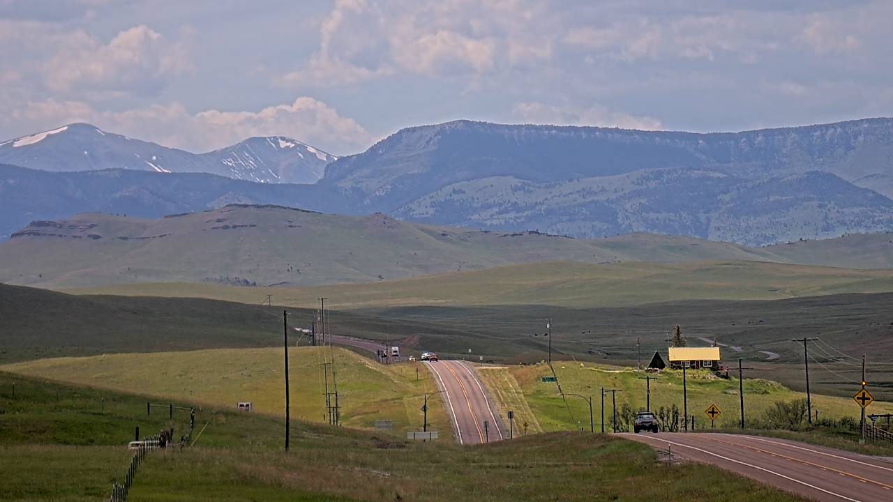
MT 200, Lewis and Clark County, Montana, USA
(from 511MT)
Lewis and Clark County is a county located in the U.S. state of Montana. As of the 2020 census, the population was 70,973, making it the 4th least populous capital county in the United States. Its county seat and most populous city is Helena, the state capital. The county has a total area of 3,498 square miles (9,060 km2), of which 3,459 square miles (8,960 km2) is land and 39 square miles (100 km2) (1.1%) is water. Montana Highway 200 (MT 200), is a route running east–west, across the entire state of Montana and is the road you see in the cam up above..
St. Mary Visitor Center,
Glacier National Park, Montana,
USA
(from
National Park Service)
The Saint Mary Visitor Center in Glacier National Park, with the connected Saint Mary Checking Station and Entrance Station was constructed at the east entrance to the Going-to-the-Sun Road during the Mission 66 park facilities improvement program.
The view from this webcam can be changed by park staff and occasionally as they will move it and provide a different aspect of the view from the St. Mary Visitor Center. They hope to be able to provide close views of the elk in the fall and winter, tighter views of the mountains, and occasionally people at the Entrance Station and in the Visitor Center.
Apgar Mountain, Glacier National Park, Montana, USA
(from National Park Service)
This view to the northeast from the summit of Apgar Mountain provides a spectacular view of Lake McDonald and the mountains in the distance. To the left of the lake are Stanton Mountain and Mt. Vaught (Stanton just in front of Vaught) and then just to the right the Garden Wall. The Continental Divide follows the crest of the Garden Wall. Continuing to the right are Mt. Cannon and Mt. Brown. The last mountain clearly visible to the right is Edwards Mountain. Apgar Lookout is at the summit and one of the more popular hikes on the west side.
Glacier National Park features a high-altitude alpine climate defined by the Continental Divide, which splits the park into two drastically different weather zones. The west side is lush and maritime-influenced, while the east side is semi-arid and windswept. Regardless of the season, conditions are highly variable. In summer (July and August): Days are warm and generally sunny (often in the 70s to 80s°F / 27°C), but nights are reliably cool. Summer weather is notoriously unpredictable; sudden rainstorms and even high-elevation snow can occur at any time. In the winter (November thru March): Most of the park is blanketed in several feet/meters of snow. Winter temperatures range from 20°F to 41°F (-6°C to 5°C), though east-side temperatures can spike dramatically due to warm, dry Chinook winds. Average annual snowfall in Glacier National Park varies, from an averages of 157 inches (398 cm) at Park Headquarters (West Glacier), to 200+ inches (508+ cm), which builds a massive snowpack that can reach depths of up to 60 feet (1,829 cm or 19 meters) in certain drifts along the Going-to-the-Sun Road in the High Country and Continental Divide areas of the park.
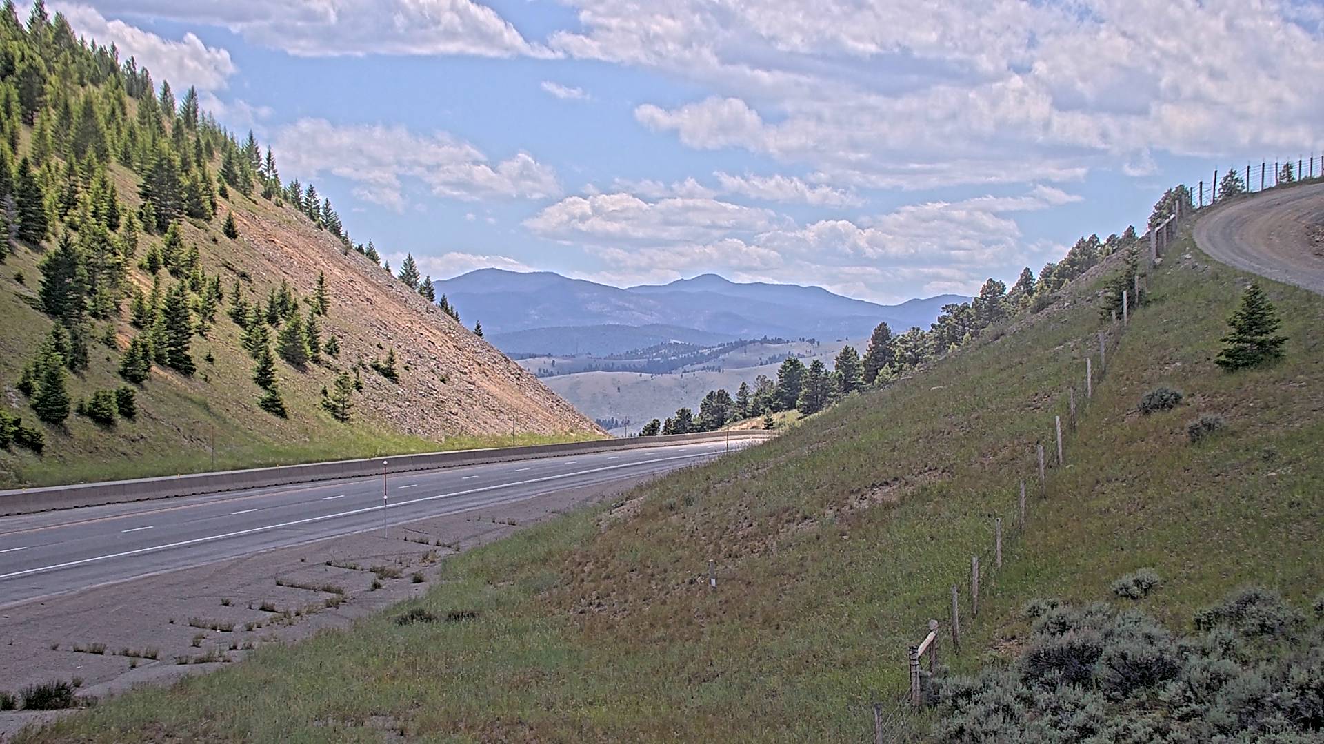
I-15, Boulder Hill, Jefferson County, Montana, USA
(from 511MT)
Boulder Hill is a section of Interstate 15 near mile marker 170.9 at about 5,600
feet (1,707 meters) elevation, and where the above cam is from. Located in Jefferson County,
the area's population was 12,085 in 2020. Its total area is
1,659 square miles (4,300 km2).
Interstate 15 is a major 1,470 mile / 2,366 kilometer transcontinental highway stretching from San Diego, California, to the Canadian border in Sweetgrass, Montana.
- Wyoming -
Wyoming is a landlocked state in the Mountain West subregion of the Western United States. It borders Montana to the north and northwest, South Dakota and Nebraska to the east, Idaho to the west, Utah to the southwest, and Colorado to the south. Its population of 576,851 (as of 2020), makes it the least populous state, despite being the 10th largest by area, with the second-lowest population density after Alaska. The state capital and most populous city is Cheyenne. Wyoming's western half consists mostly of the ranges and rangelands of the Rocky Mountains; its eastern half consists of high-elevation prairie, and is referred to as the High Plains. The federal government owns just under half of Wyoming's land, generally protecting it for public use. The state ranks sixth in the amount of land that is owned by the federal government. Overall, the state's total land area is 97,813 sq. mi (253,335 km2).
Wyoming's climate is semi-arid and continental and is drier and windier in comparison to most of the United States, with great temperature extremes. Summers in Wyoming are warm and winters are cold but variable with periods of extreme cold interspersed between generally mild periods, thanks to Chinook winds providing unusually warm temperatures in some locations. Being a very dry state, much of its land receives less than 10 inches (250 mm) of rainfall per year. Precipitation depends on elevation, with lower areas in the Big Horn Basin averaging just 5 to 8 inches (130 to 200 mm) a year, making this area desert like. The lower areas in the North and on the eastern plains average around 10–12 inches (250–300 mm) annually, with the climate there semi-arid. Some mountain areas do receive a good amount of precipitation, 20 inches (510 mm) or more, with much of it falling as snow, sometimes 200 inches (510 cm) or more annually. Silver Gate, Montana received 853 inches of snow during the 2022-2023 season, a record for the state. The state's highest recorded temperature was a hot 114°F (46°C) at Basin on July 12, 1900, and the lowest recorded temperature ever was −66°F (−54°C) at Riverside on February 9, 1933.
Grand Teton National Park,
Wyoming, USA
(from GrandTetonFoundation)
Grand Teton National Park is in the northwestern part of the U.S state of Wyoming. It encompasses the valley known as Jackson Hole. It’s a popular destination in summer for mountaineering, hiking, backcountry camping and fishing. Soaring over a landscape rich with wildlife, pristine lakes, and majestic alpine vistas, the park boasts 310,000 acres (130,000 ha; 1,300 km 2) of lush valley floors, mountain meadows, alpine lakes and the rising peaks of the Teton mountain range, including the 13,775 foot (4,199 meter) Grand Teton peak. The park has numerous lakes, including 15-mile-long (24 km) Jackson Lake as well as streams and the upper main stem of the Snake River. Though in recession, a dozen small glaciers persist at the higher elevations near the highest peaks in the range. Some of the rocks in the park are the oldest found in any American national park and have been dated at nearly 2.7 billion years.
According to the Köppen climate classification system, Grand Teton National Park has a humid continental climate. Its all-time record high temperature is 95°F (34°C), recorded at the Moose weather station on August 17, 2020, while it's coldest temperature was set in February 9, 1933 at -63°F (-53°C). Average annual snowfall is 166 inches (422.1 centimeters).

Devils Tower National Monument, Wyoming, USA
(from National Park Service)
Devils Tower is an astounding geologic feature that protrudes out of the prairie surrounding the Black Hills. It is considered sacred by Northern Plains Indians and indigenous people. Indigenous names for the monolith include "Bear's House" or "Bear's Lodge" (or "Bear's Tipi", "Home of the Bear", "Bear's Lair"). Standing 867 feet (264 meters) from summit to base, its summit elevation is 5,112 feet (1,558 meters) above sea level.
Devils Tower experiences a semi-arid climate characterized by hot, dry summers and cold, snowy winters. Temperatures are highly variable, ranging from sub-zero lows in the winter to triple-digit highs in the summer. Highest temp ever was a very hot 108°F (42°C) set in July, while the lowest reading was set on a very cold December morning at -48°F (-44°C). The average snow season sees 48.8 inches (123.6 centimeters) fall and year-round precipitation is 19 inches (484 millimeters).
Grand Targhee Resort Summit Zoom Cam, Alta, Wyoming, USA
(From
See Jackson Hole)
Alta is in western Wyoming in the Caribou-Targhee National Forest, in Teton County, Wyoming, with a population of 429 at the 2020 census. It's located between Driggs, Idaho and the Grand Targhee ski resort, located just east of the Idaho state line, approximately 5 miles (8 km) east of Driggs, at an elevation of 6,440 feet (1,963 m) above sea level. Alta has a total area of just 8.3 square miles (21 km2). It has a warm-summer humid continental climate. The hottest temperature recorded in Alta was 97°F (36 C) on July 16, 1925, while the coldest temperature recorded was −46°F (−43°C) on February 9, 1933. The town sees 113.4 inches of snow (287.46 centimeters) on average per year.
Grand Targhee Resort is a ski resort near Alta, the closest town to the resort. It is 42 miles (68 km) northwest of Jackson and is accessible only from the west, through Driggs, Idaho. The border with Idaho is less than five miles (8 km) due west. The ski resort has one high-speed six-pack, two high-speed quads, two fixed-grip quads, and one magic carpet. Its base is located at 7,851 feet (2,393 m), with its vertical drop being 2,270 feet (690 m). It averages over 500 inches (41.7 ft.; 12.7 m) of snowfall per season, which ranks it among the top five ski resorts in North America for snowfall. It's located 670 miles (1,080 km) inland and the snow that falls is nearly always powder snow, which is the case for most ski resorts in the Mountain West.
Creek by Rustic Inn, Jackson Hole, Wyoming,
USA
(From See Rustic Inn)
Jackson Hole is a valley between the Gros Ventre and Teton mountain ranges, near the border with Idaho. The term "hole" was used by early trappers, or mountain men, for a large mountain valley. Jackson Hole is 55 miles (89 km) long by 6-to-13 miles (10-to-21 km) wide and is a graben valley with an average elevation of 6,800 ft. (2,100 m), with its lowest point being near the southern park boundary at 6,350 ft. (1,940 m). The valley was used by Native Americans for hunting and ceremonial purposes. It was not known to harbor year-round human settlement prior to the 1870s. The valley sees a lot of snow, with record snow at Jackson Hole Mountain Resort, with an all-time snow total record of 595 inches/1,5113 mm recorded in Rendezvous Bowl.
The Creek by Rustic Inn is a 4 star resort located in Jackson, and we thank them for their wonderful cam! Check them out when you're in the area.
Mammoth Hot Springs, Travertine Terraces, Wyoming,
USA
(From
National Park Service)
The travertine terraces of Mammoth Hot Springs are shown above. This hot spring at Yellowstone is known for its dynamic, colorful, ever-changing travertine formations. Terraces form when water rises through limestone, which then allows the water to carry high amounts of dissolved calcium carbonate. At the surface, carbon dioxide is released and the calcium carbonate is deposited, forming travertine, the chalky white rock of the terraces. In the foreground are the parade grounds for historic Fort Yellowstone—the focal point of daily life at the fort.
- Colorado -
Colorado is located in the US Mountain West, and has a diverse landscape of arid desert, river canyons, high tundra, high plains, huge sand dunes and the snow-covered Rocky Mountains, including the famous Rocky Mountain National Park. Elsewhere, Mesa Verde National Park features Ancestral Puebloan cliff dwellings. Perched a mile above sea level, Denver, Colorado’s capital and largest city, features a vibrant downtown area. On its eastern side is where the Great Plains end their westward trek. Colorado is the eighth largest state at 104,185 sq. mi (269,837 sq. km), and 21st most populous U.S. state. It borders Wyoming to the north, Nebraska to the northeast, Kansas to the east, Oklahoma to the southeast, New Mexico to the south, Utah to the west, and meets Arizona to the southwest, at the Four Corners, the only location in the US where four states meet (Colorado, Utah. Arizona and New Mexico).
Colorado's is the highest state in the United States, with an average elevation of 6,800 feet (2,074 meters) above sea level. At 14,440 feet/4,401 meters, Mount Elbert is the highest point in Colorado and second highest point in the continental U. S., and Leadville, at 10,158 feet/3,096 meters, is the highest-elevation city in the continental U.S. Colorado is home to fifty-eight of the nation's ninety-six mountain peaks standing at or above 14,000 feet in elevation. Known as “Fourteeners,” these peaks dominate Colorado’s skyline and shape the way people live and identify with nature in the Rocky Mountain West.
Colorado joined the U.S. as the 38th state in 1876. The region has been inhabited by Native Americans and their ancestors for at least 13,500 years and possibly much longer. The eastern edge of the Rocky Mountains was a major migration route for early peoples who spread throughout the Americas.
The estimated population of Colorado in 2023 was 5,877,610. Roughly 70% of Colorado's population resides along the eastern edge of the Rocky Mountains, known as the Front Range, which lies between Cheyenne, Wyoming, and Pueblo, Colorado. This region is partially protected from prevailing storms that blow in from the Pacific Ocean region, and storms that form in the nearby high Rockies. The Front Range, with some of its locations located in the foothills, includes Denver, Boulder, Fort Collins, Loveland, Castle Rock, Colorado Springs, Pueblo, and other townships and municipalities in between.
West of the Great Plains of Colorado rises the foothills and slopes of the Rocky Mountains. Notable peaks include Longs Peak, Mount Blue Sky, Pikes Peak, and the Spanish Peaks in southern Colorado. The Continental Divide of the Americas, in Colorado, extends from north to south, following a serpentine path through Routt, Jackson, Larimer, Grand, Boulder, Gilpin, Clear Creek, Summit, Park, Lake, Eagle, Pitkin, Gunnison, Chaffee, Saguache, Hinsdale, San Juan, Mineral, Rio Grande, Conejos, and Archuleta Counties. West of the Continental Divide, water flows to the southwest via the Colorado River and the Green River into the Gulf of California. To the east, rivers like the Rio Grande and Arkansas Rivers drains to the southeast, ultimately either via the Mississippi River or the Rio Grande into the Gulf of Mexico.
The climate of Colorado is more complex than most other U.S. states. Unlike most places, southern Colorado is not always warmer than northern Colorado. Most of Colorado is made up of mountains, foothills, high plains, and desert lands, and the mountains and surrounding valleys greatly affect the local climate. The climate of the Eastern Plains is semi-arid with low humidity and moderate precipitation. In summer, this area can have many days above 95°F (35°C) and often 100°F (38°C), along with humidity readings under 10%. On the plains, the winter lows usually range from 25 to −10°F (−4 to −23°C). March is the snowiest month there. West of the plains and into the foothills, there is a wide variety of climate types. Locations merely a few miles apart can experience entirely different weather depending on the topography. This area sees semi-arid climate, like the eastern plains, but here it transitions to an alpine climate at the highest elevations. Extreme weather changes are common in Colorado. Thunderstorms are common east of the Continental Divide in the spring and summer, yet are usually brief. Hail is a common sight in the mountains east of the Divide, in their foothills, on the Front Range, and across the eastern Plains. It hails in these areas more than anywhere else on Earth, being tied with the Himalayas in India for that title. Yet in Colorado's Rockies west of the Great Divide, they see little or no hail, and few thunderstorms the further west one travels. Plus, when talking about server weather in the eastern part of the state, it should be noted that the Eastern High Plains are on the western portion of Tornado Alley - which ends mainly at the Colorado Front Range.
As far as snow goes, the spot in Colorado that sees the most snow is Wolf Creek Pass, at the Wolf Creek Ski Area. At an elevation of 11,904 feet (3,628 meters), it receives over 400 inches (1,016 centimeters) of snow each year on average. Wolf Creek holds Colorado record snowfall season with 807 inches of snow (2,0500 centimeters) during the 1978-1979 season.
All of the Colorado mountains over 12,000 feet (3,658 meters) will sometimes see snow in July and August. The 24 hour snowfall record in the state was at Silver Lake, when 75.8 inches (93 centimeters) fell from the afternoon on April 14, into the next morning. Temperature records in Colorado are, for the highest reading: 115°F (46°C) on July 20, 2019, recorded at John Martin Dam near Las Animas, and for the lowest temperature in the state, that was -61°F (-52°C) on February 1, 1985, recorded in Maybell.

0.2 miles W of Tunnel 1, Colorado, USA
(From CDOT)
Clear Creek flows from the Continental Divide at Loveland Pass, eastward through a deep and wide glacial valley down to Idaho Springs, where the valley narrows and the stream gradient increases as it enters narrow, relatively undeveloped Clear Creek Canyon. Other than the two-lane US Highway 6, which hugs the creek, the canyon is nearly pristine, providing a major wilderness recreational area at the western edge of the Denver metro area. There are no buildings in the inner gorge, and most of the outer gorge has escaped encroachment by home construction and attendant roads. Although all the land was homesteaded in the late 1800s and used for cattle grazing and local hay production, a combination of rugged landscape, enlightened landowners, and local residents allowed it to remain undeveloped into the 1980s, when a combination of public and private land conservation efforts started the process of limiting development forever. Today, the Clear Creek Land Conservancy owns 600 acres on the south side of the canyon and holds conservation easements on 1,300 additional acres of private land, ensuring it will never be developed.
As far as the tunnels go, most of the roadway and tunnels through Clear Creek Canyon were built between 1937 and 1941 and between 1945 and 1952, as most construction was halted during World War II. Originally there were six tunnels, but Tunnel #4 near the intersection with State Highway 119 was closed down and is no longer in use. Built in 1939, the 191.9 foot (191.9) long tunnel was barricaded from use in 1998 when the intersection joining U.S. 6 and SH 119 was relocated to the southeast.
Tunnel 1 is located on Hwy 6, east of Idaho Springs and west of Golden, Colorado (To see the cam view inside Tunnel 1, go to my Colorado Webcam site page for it, here. To see Tunnels 2,3 and 5, go here, and to see the closed, abandoned Tunnel 4, go here).
Mt Princeton Hot Springs - Spa Slides
(from
Colorado Webcam)
Mount Princeton is a high mountain summit at 14,204 feet (4,329.4 meters) of the Collegiate Peaks in the Sawatch Range of the Colorado Rocky Mountains. The fourteener is located in San Isabel National Forest. The nearby Mt Princeton Hot Springs are between the ghost town of St Elmo, and Nathrop, Colorado, on Country Rd 162, and are also located between the towns of Buena Vista and Salida, Colorado, off Colorado Hwy 285. The elevation at the hot springs is 8,250 feet (2,514 meters), and is a true gorgeous natural oasis surrounded by towering peaks. The hot springs here are open daily to the public, year-round (but the twin 700-foot waterslides shown above, are seasonal), offering its natural mineral hot springs, modern pools, and wonderful mountain views. The springs and pools temperature range from 70°F to 107°F* (or 21°C to 42°C*), *but sometimes they are hotter.
Climate wise, historical monthly air temperatures averages at Mt Princeton Hot Springs are, in January (the dead of winter) the average high is 34°F (1.1°C) and the average low is 14°F (-10°C), and in the peak of the summer, in July, the average high is 77°F (25°C) , with the overnight low at 51°F (11°C). Map and more views are here.
Crestone Baca, Colorado, USA
(Zoom Mountain Tour from
Colorado WebCams)
The Town of Crestone is an isolated community located in south-central Colorado, in Saguache County, in the foothills of the Sangre de Cristo Mountains, a mountain chain of the Rocky Mountains and one of the longest fault-block mountain ranges in the world. The webcams are located south of Crestone in the Baca Grande. The Baca is a spiritual center, with several world religions represented here, including: a Hindu temple, a couple of Zen centers, several Tibetan Buddhist centers, different retreat centers, and miscellaneous New Age happenings. Crestone's elevation is 7,923 feet (2,415 meters). However, in the Baca, the elevation varies, with an average elevation of 8,100 feet (2,469 meters). As of the 2020 census, the population of Crestone was 141, but most of the locals live in the Baca, with an estimated population of 2,000 people.
Crestone is named for the 14,000-foot (1,917 meter) plus high mountains that lie just east of the town. Just to the south and next door to the Baca are the tallest sand dunes in North America, at the Great Sand Dunes National Park and Preserve. Inside this National Park, besides the beautiful tall sand dunes, on the park's north end, bordering the Baca, is the Crestone Crater, which was possibly formed by a meteorite impact in 1892, but it's still being studied to determined if it is indeed one. You can click here if you would like to read a newspaper article I wrote about it in 2011.
The climate in Crestone brings mild summers and cold winters. Down below Crestone is the San Luis Valley, the highest and largest alpine valley in the world, and it is also a semi-desert - and a very cold one at that - as it's the second coldest valley in the lower 48 states (the Gunnison Valley, located in the next valley over to the west, is the coldest). The coldest temperature ever in the Crestone/Baca was -26°F/-32°C set on February 1, 1986, and the warmest day was 98°F (38°C) on July 20, 2005. The snowiest snow season in Crestone since 1982, was in 2008-09, back when I, your webmaster, measured 99 inches (252 centimeters) of snow**. Average annual snowfall is 64.0 inches (163 centimeters).
This cam shows and covers about 270 degrees of the local area, including the Crestone area mountains, the northern San Luis Valley, and the San Juan Mountains to the west. Average elevation of the mountain peaks shown are around 14,000 feet (1,917 meters). To see a list of these mountain peaks and their elevation that are seen on the cam, please go here.
**Yes, Crestone is my hometown and I have been the official COOP (Cooperative Observer) reporter in the Crestone-Baca for the National Weather Service since I moved here in 2002. Plus yes, this cam and my other 4 cams (all 5 are shown on my Crestone WebCam Page) are all located up on top of my home's 30 foot (91 meters) high weather tower. You can checkout those cams by clicking on the link directly above.
- You can checkout a lot more Colorado Webcams (from over 200 locations in the state) at my Colorado Webcams site -
- Utah -
Utah is a landlocked state in the Mountain West subregion of the Western U.S. It is one of the Four Corners states, sharing a border with Arizona, Colorado, and New Mexico. It also borders Wyoming to the northeast, Idaho to the north, and Nevada to the west. In comparison to all the U.S. states and territories, Utah, with a population of just over three million, is the 13th largest by area, the 30th most populous, and the 11th least densely populated.
Slightly over half of all Utahns are Mormons, with the vast majority of whom are members of the Church of Jesus Christ of Latter-day Saints (LDS Church), which has its world headquarters in Salt Lake City. It is the only state where a majority of the population belongs to a single church. The LDS Church greatly influences Utah's culture, politics, and daily life.
Utah features a dry, semi-arid to desert climate, although its many mountains feature a large variety of climates. Most of the lowland areas receive less than 12 inches (31.8 cm) of precipitation annually, although the I-15 corridor, including the densely populated Wasatch Front, receives approximately 15 inches (39.4 cm) per year. The Great Salt Lake Desert is the driest area of the state, with less than 5 inches (12.7 cm) annually. Snowfall is common in all but the far southern valleys. While St. George in southwestern Utah receives only about 3 inches (7.6 cm) per year, Salt Lake City in the northern part of the state, sees about 60 inches (162 cm), enhanced by the lake-effect snow from the Great Salt Lake, which increases snowfall totals to the south, southeast, and east of the lake.
Utah's temperatures are extreme, with cold temperatures in winter due to its elevation, and very hot summers statewide (except for mountain areas and high mountain valleys). Average January high temperatures range from around 30°F (−1°C) in some northern valleys to almost 55°F (13°C) in St. George. Temperatures dropping below 0°F (−18°C) should be expected on occasion in most areas of the state in most years. In July, average highs range from about 85 to 100°F (29 to 38°C). However, the low humidity and high elevation typically lead to large temperature variations, leading to cool nights on most summer days. The record high temperature in Utah was 118°F (48°C), recorded south of St. George on July 4, 2007, while the record low was −69°F (−56°C), recorded at Peter Sinks in the Bear River Mountains of northern Utah on February 1, 1985.

US 191 at
Arches
National Park
Entrance Station,
Utah, USA
(from
The National Park Service)
US 191 near the entrance to
Arches National Park, Utah, USA
(from
UDOT)
Arches National Park has over 2,000 natural stone arches, hundreds of soaring pinnacles, massive rock fins, and giant balanced rocks. This national park is located in eastern Utah, just 55 miles from the Utah/Colorado border via UT Hwy 46 and CO Hwy 90. The park is adjacent to the Colorado River, 4 mi (6 km) north of Moab, Utah. The park contains more than 2,000 natural sandstone arches, including the well-known Delicate Arch, which constitute the highest density of natural arches in the world. It also contains a variety of other unique geological resources and formations. The national park lies above an underground evaporate layer or salt bed, which is the main cause of the formation of the arches, spires, balanced rocks, sandstone fins, and eroded monoliths in the area.
The park consists of 310.31 km2 (76,680 acres; 119.81 sq. mi; 31,031 ha) of high desert located on the Colorado Plateau. The highest elevation in the park is 5,653 ft. (1,723 m) at Elephant Butte, and the lowest elevation is 4,085 ft. (1,245 m) at the visitor center. The park receives an average of less than 10 inches (250 mm) of rain annually and only around 8 inches (203 mm) of snow. Temperature wise, the summers are hot and dry here, with the average mean high in the mid 80s, with the record high of 108°F (42.2°C), while the winters aren't really that cold at all, with an average high January mean temperature of 55°F (13°C). The coldest ever reading in winter was set in February, at −8°F (−22°C). Arches' also sees little snow, averaging only 5 snow days a year, with a yearly accumulation of just 8.1 inches (21 cm).

Zion Canyon, The Temples and Towers of
the Virgin, Zion
National Park,
Utah, USA
(from
The National Park Service)
Zion National Park, in southwest Utah, is a nature preserve distinguished by Zion Canyon’s steep red cliffs. Zion Canyon Scenic Drive cuts through its main section, leading to forest trails along the Virgin River. The river flows to the Emerald Pools, which have waterfalls and a hanging garden. Also along the river, partly through deep chasms, is Zion Narrows wading hike. Located in southwestern Utah near the town of Springdale, at the junction of the Colorado Plateau, Great Basin, and Mojave Desert regions, the park has a unique geography and a variety of life zones that allow for unusual plant and animal diversity. 289 species of birds, 75 mammals (including 19 species of bat), and 32 reptiles inhabit the park's four life zones. It includes mountains, canyons, buttes, mesas, monoliths, rivers, slot canyons, and natural arches. The lowest point in the park is 3,666 feet (1,117 meters) at Coalpits Wash and the highest peak is 8,726 feet (2,660 meters) at Horse Ranch Mountain. Zion sees a cold semi-arid climate consisting of very hot summers and mild winters with a limited amount of precipitation throughout the year. It's highest ever temperature was 115°F (46°C) while the coldest was -15°F (-26°C). The park sees little snowfall, with just 4.0 inches (10 cm) each snow season. It sees a bit more rain, with 16.27 inches (413 mm) each year.
- Arizona -
Arizona is a state in the Southwestern region of the U. S., sharing the Four Corners region of the western United States with Colorado, New Mexico, and Utah. It also borders Nevada to the northwest and California to the west, and shares an international border with the Mexican states of Sonora and Baja California to the south and southwest. Its capital and largest city is Phoenix, which is the most populous state capital and fifth most populous city in the US.
Arizona is the 6th-largest state by area and the 14th-most-populous of the 50 states. It is the 48th state and last of the contiguous states to be admitted to the Union, achieving statehood on February 14, 1912. Southern Arizona is known for its desert climate, with extremely hot summers and mild winters. Northern Arizona features forests of pine, Douglas fir, and spruce trees; the Colorado Plateau; mountain ranges; as well as large, deep canyons, with much more moderate summer temperatures and significant winter snowfalls. There are ski resorts in the areas of Flagstaff, Sunrise, and Tucson. In addition to the internationally known Grand Canyon National Park, which is one of the world's seven natural wonders, there are several national forests, national parks, and national monuments.
The State has a diverse population. About one-quarter is made up of Indian reservations that serve as the home of 27 federally recognized Native American tribes, including the Navajo Nation, the largest in the state and the country, with more than 300,000 citizens. Arizona's population and economy have grown dramatically since the 1950s because of inward migration, and the state is now a major hub of the Sun Belt. As of 2024, its estimated population was 7,582,384.
Arizona is also home to one of the most well-preserved meteorite impact sites in the world. Created around 50,000 years ago, the Barringer Meteorite Crater (better known simply as "Meteor Crater") is a gigantic hole in the middle of the high plains of the Colorado Plateau, about 25 miles (40 km) west of Winslow. The crater itself is nearly a mile (1.6 kilometers) wide and 570 feet (170 m) deep.
Due to its large area and variations in elevation, the state has a wide variety of localized climate conditions. In the lower elevations the climate is primarily desert, with mild winters and extremely hot summers. Typically, from late fall to early spring, the weather is mild, averaging a minimum of 60°F (16°C). November through February are the coldest months, with temperatures typically ranging from 40 to 75°F (4 to 24°C), with occasional frosts. The summer months of June through September bring a dry heat from 90 to 120°F (32 to 49°C), with occasional high temperatures exceeding 125°F (52°C) having been observed in the desert area. Arizona's all-time record high is 128°F (53°C) recorded at Lake Havasu City on June 29, 1994, and July 5, 2007; the all-time record low of −40°F (−40°C) was recorded at Hawley Lake on January 7, 1971. Arizona has an average annual rainfall of 12.7 in (323 mm).

In this north-facing view, the Battleship formation is in the center, and Havasupai Gardens (formerly known as Indian Garden) is visible - lower right, 3000 feet (915 meters) below. Kolb Studio was the family home and photography studio of the Kolb Brothers, pioneer photographers at Grand Canyon.
Entirely located within the state of Arizona, the park encompasses 278 miles (447 km) of the Colorado River and adjacent uplands. The Grand Canyon is a steep-sided canyon carved by the Colorado River in Arizona. Its layered bands of red rock reveal millions of years of geological history. Viewpoints include Mather Point, Yavapai Observation Station and architect Mary Colter’s Lookout Studio and her Desert View Watchtower. Lipan Point, with wide views of the canyon and Colorado River, is very popular, especially at sunrise and sunset.
There's way too much more to talk about at this wonderful park and canyon, but since space is limited here, I'll leave it to the many other websites out there to tell you more and how much you need to check out this special place at least once in your life!
Weather in the Grand Canyon varies according to elevation. Temperatures on the North Rim are generally lower than those on the South Rim because of the greater elevation (averaging 8,000 feet or 2,400 meters above sea level). The forested rims are high enough to receive winter snowfall, but along the Colorado River in the Inner Gorge, temperatures are similar to those found in Tucson and other low elevation desert locations in Arizona. Average annual precipitation on the South Rim is less than 16 inches (41 cm), with 60 inches (150 cm) of snow; the higher North Rim usually receives 27 inches (69 cm) of moisture, with a typical snowfall of 144 inches (370 cm); and Phantom Ranch, far below the canyon's rims along the Colorado River at 2,500 feet (760 m) gets just 8 inches (200 mm) of rain, and snow there is a rarity.
Temperatures vary wildly throughout the year, with summer highs within the Inner Gorge commonly exceeding 100°F (38°C) and winter minimum temperatures sometimes falling below zero degrees Fahrenheit (−18°C) along the canyon's rims. The record high temperature for the South Rim is 105°F (41°C) on June 26, 1974, and the record low temperature was −20°F (−29°C) on January 1, 1919, February 1, 1985, and December 23, 1990. Visitors are often surprised by the canyon's potentially extreme conditions, and this, along with the high altitude of the canyon's rims, can lead to unpleasant side effects such as dehydration, sunburn, and hypothermia. So do be prepared when visiting this grand canyon.
- Nevada -
Las Vegas, aka Sin City or simply Vegas, is the most populous city in the U.S. state of Nevada. The Las Vegas Valley metropolitan area is the largest within the greater Mojave Desert, and second-largest in the Southwestern United States. Las Vegas is an internationally renowned major resort city, known primarily for its gambling, shopping, fine dining, entertainment, and nightlife, with most venues centered in downtown Vegas and more on the Las Vegas Strip, just outside city limits. The city had 641,903 residents in 2020, with a metropolitan population of 2,227,053, making it the 25th-most populous city in the States.
The city bills itself as the Entertainment Capital of the World, and is famous for its luxurious and extremely large casino-hotels. With over 40.8 million visitors annually as of 2023, it's one of the most visited cities in the U.S. The city's elevation is approximately 2,030 ft. (620 m) and has an area of 135.86 sq. mi (351.9 km2).
Vegas has a subtropical hot desert climate, typical of the Mojave Desert in which it lies. It has extremely hot summers, and short winters with mild days and cool nights. There is abundant sunshine throughout the year, with an average of 310 sunny days. Rainfall is scarce, with an average of 4.2 in (110 mm) per year. Las Vegas is among the sunniest, driest, and least humid locations in North America. July is the hottest month, with an average daytime high of 104.5°F (40.3°C). On average, 137 days per year reach or exceed 90°F (32°C), of which 78 days reach 100°F (38°C) and 10 days reach 110°F (43°C). Summer overnight lows frequently remain above 80°F (27°C). The all-time record high low is 95°F (35°C), set in 2005. The highest temperature officially observed in Las Vegas is 120°F (48.9°C), set on July 7, 2024. The lowest temperature was 8°F (−13°C), recorded on two days: January 25, 1937, and January 13, 1963. Plus yes, it does snow once in a blue moon in Vegas. The most recent accumulations occurred on February 18, 2019, when parts of the city received about 1 to 2 inches (2.5 to 5.1 cm) of snow. Unofficially, Las Vegas's largest snowfall was 12 inches (30 cm) that fell in 1909.
Las Vegas Strip, Nevada, USA
(From LV Strip Cam )
The Las Vegas Strip is a stretch of Las Vegas Boulevard in Clark County, Nevada, that is known for its concentration of resort hotels and casinos. The Strip, as it is known, is about 4.2 mi (6.8 km) long, and is immediately south of the Las Vegas city limits in the unincorporated towns of Paradise and Winchester, but is often referred to simply as "Las Vegas". Many of the largest hotel, casino, and resort properties in the world are on the Strip.
- Washington State -
Washington, officially the State of Washington, is the westernmost state in the Pacific Northwest region of the United States. It is often referred to as Washington state to distinguish it from the national capital, both named for George Washington. Washington borders the Pacific Ocean to the west, Oregon to the south, Idaho to the east, and the Canadian province of British Columbia to the north. It was admitted to the Union as the 42nd state in 1889. Olympia is the state capital, and the most populous city is Seattle. It's the 18th-largest state, with an area of 71,362 square miles (184,830 km2), and the 13th-most populous state, with more than 7.8 million people. The majority of Washington's residents live in the Seattle metropolitan area.
Mount Rainier, an active stratovolcano, is the state's highest elevation at 14,411 feet (4,392 meters), and is the most topographically prominent mountain in the contiguous U.S. The U.S. Geological Survey considers Mount Rainier the most dangerous volcano in the Cascade Range, due to its proximity to the Seattle metropolitan area, and most dangerous in the continental U.S. according to the Decade Volcanoes list. It is also covered with more glacial ice than any other peak in the contiguous 48 states.
Washington has a temperate climate. The eastern half has a semi-arid to warm-summer mediterranean climate, while the western side of Washington as well as the coastal areas of the state have a cool oceanic climate. Western Washington is very cloudy during much of fall, winter, and early spring. Seattle averages the least sunshine hours of any major city in the U.S. Rainfall in Washington varies dramatically going from east to west. The Olympic Peninsula's western side receives as much as 160 inches (4,100 mm) of precipitation annually, making it the wettest area of the 48 conterminous states and a temperate rainforest. Weeks may pass without a clear day. The western slopes of the Cascade Range receive some of the heaviest annual snowfall (in some places more than 200 inches or 5,100 millimeters water equivalent) in the country. In the rain shadow area east of the Cascades, the annual precipitation is only 6 inches (150 mm). Precipitation then increases again eastward toward the border with Idaho. The highest recorded temperature in the state was 120°F (49°C) at Hanford on June 29, 2021. The lowest temperature recorded in the state was −48°F (−44°C) on December 30, 1968 in Winthrop and Mazama.

Tatoosh - Mount Rainier National Park, Washington, USA
Looking south towards the Tatoosh Range from Paradise.

Paradise - Mount Rainier National Park, Washington, USA
(First 2 cams from https:www.nps.gov/)
Mount Rainier National Park is a national park of the United States and is located in southeast Pierce County and northeast Lewis County in Washington state. An active volcano, ascending to 14,410 feet (4392 meters) above sea level, Mount Rainier is the most glaciated peak in the contiguous U.S.A.,spawning five major rivers. Subalpine wildflower meadows ring the icy volcano while ancient forest cloaks Mount Rainier’s lower slopes. Wildlife abounds in the park’s ecosystems.
The park was established on March 2, 1899, as the fourth national park in the United States, preserving 236,381 acres (369.3 sq mi; 956.6 km2). Ninety-seven percent of the park is preserved as wilderness under the National Wilderness Preservation System as Mount Rainier Wilderness, a designation it received in 1988.
Mount Rainier Park has a Mediterranean-influenced humid continental climate or subarctic climate, depending on the elevation. The National Park Service says that "Paradise is the snowiest place on Earth where snowfall is measured regularly". It's most snow in a season was during the 1971/72 snow year, when 1,122 inches (2,050 cm) of snow fell, with average snowfall per season being 670.8 inches (1,702.4 cm).
UW Continuum College Cam, Seattle, Washington, USA
(From
UW Video)
Seattle, the birthplace of global coffee cultureis, is a city on Puget Sound in the Pacific Northwest, surrounded by water, mountains and evergreen forests, and contains thousands of acres of parkland. Sitting at a elevation of 148 feet (45 meters), it's Washington State’s largest city, with a population of 755,078 (in 2023), it’s home to a large tech industry, with Microsoft and Amazon headquartered in its metropolitan area. The futuristic Space Needle, a 1962 World’s Fair legacy, is its most iconic landmark.
This cam is atop the UW Tower, and provids the highest view north of downtown Seattle. Panoramic views range from Lake Washington and the Cascade Mountains to downtown Seattle, across Lake Union and to the Seattle Space Needle. The UW Tower houses more than 2,000 university employees and 65 different departments, including UW Continuum College.
Leavenworth, Washington, USA
(From
Visit Leavenworth)
Leavenworth is a Bavarian-styled village in the Cascade Mountains, in central Washington State. Alpine-style buildings with restaurants serving German beer and food line Front Street. The population was 2,263 at the 2020 census. The city has a total area of 1.25 square miles (3.24 km2). Leavenworth has a continental Mediterranean climate with summers characterized by hot, sunny days and chilly nights, and cold, snowy winters. When a continental flow enters the Columbia Basin, the temperature can be very hot during the day, with the hottest temperature ever being 110°F or 43.3°C during the heat wave of July 1941. The lowest temperature recorded was −36°F (−37.8°C) on December 30, 1968.
- Oregon -
Oregon, the 33rd state, is a part of the Western United States, in the Pacific Northwest and is bounded by the Pacific Ocean to the west, Washington to the north, Idaho to the east, and California and Nevada to the south. Most of Oregon's population lives west of the Cascade Range in the Willamette Valley. The state's diverse landscape includes rainforests, mountains, and deserts. Its average elevation is 3,300 feet (1,000 meters), with its highest spot Mount Hood at 11,249 feet (3,429 meters) and lowest elevation is at the Pacific Ocean at 0 feet (0 meters).
With over 98,000 square miles (250,000 km2), Oregon is the ninth-largest and 27th-most populous U.S. state, with 4.2 million people live here as of 2025. Oregon has been home to many indigenous nations for thousands of years. The first European traders, explorers, and settlers began exploring what is now Oregon's Pacific coast in the early to mid-16th century.
Most of Oregon has a generally mild climate, though there is significant variation given the variety of landscapes across the state. The state's western region (west of the Cascade Range) has an oceanic climate, populated by dense evergreen mixed forests. Western Oregon's climate is heavily influenced by the Pacific Ocean; the western third of Oregon is very wet in the winter, moderately to very wet during the spring and fall, and dry during the summer. Oregon's highest ever temperature is a scorching 119°F (48°C), which was set three times, first at Prineville on July 29, 1898, and tied at Pendleton on August 10, 1898, and Pelton Dam on June 29, 2021. The lowest recorded temperature is −54 °F (−48 °C) at Seneca on February 10, 1933.

Crater Lake, Oregon, USA
(from
National Park Service)
Crater Lake National Park, the state's only national park, is the site of the deepest lake in the U.S. at 1,943 feet (592 meters) and the second-deepest in North America and the tenth-deepest in the world. This view looks north across the lake from the Sinnott Overlook at Rim Village (elevation 7,100 feet / 2,164 meters). On a clear day, it takes in Wizard Island, Llao Rock, and Mount Thielsen.
Crater Lake National Park is located in southern Oregon. Established in 1902, it's the fifth-oldest national park in the United States. The park has a dry-summer subarctic climate. In winter, while snow is relatively rare at low elevations in western Oregon, it's common at higher elevations, especially at Crater Lake. Measurements at park headquarters show that snow falls more here than at any other long-term weather station in the state. Although snow covers the park for eight months of the year, and it receives an average annual snowfall is 463 inches (1,180 centimeters), the lake rarely freezes over due, to a relatively mild onshore flow from the Pacific Ocean. The coldest temp ever here was set in January at −21°F (−29°C), while the hottest reading ever was set in July at 100°F (38°C).

John Day Fossil Beds National Monument, Oregon, USA
(From
USGS)
John Day Fossil Beds National Monument is a U.S. national monument in Wheeler and Grant counties in east-central Oregon. Located within the John Day River basin (The river was named for early 19th-century fur trader John Day) and managed by the National Park Service, the park is known for its well-preserved layers of fossil plants and mammals. The monument cover a total of 14,062 acres (5,691 hectares) of semi-desert shrublands, riparian zones, and colorful badlands.
The fossils at John Day span 40 million years and offer one of the richest evolutionary records of the Cenozoic Era, including prehistoric alligators, bears, dogs, pigs, horses, cougars and even hippopotamuses. The Thomas Condon Paleontology Center in the Sheep Rock Unit (where the above cam is located) has more than 500 of these fossils on display.
Mt Bachelor, near Bend,
Oregon, USA
(from Mt. Bachelor)
Mount Bachelor Ski Resort (aka Mt. Bachelor) is a ski resort located in Central Oregon, approximately 22 miles (35 km) west of Bend, along Century Drive Highway. The ski area is on the northern side of Mount Bachelor, a stratovolcano rising atop a volcanic shield in the Cascade Range. It is the largest ski resort (by area) by more than 1,000 acres (4.0 km2) in Oregon, the second largest single-mountain ski resort in the U.S. behind Vail in Colorado, and the sixth largest of all ski resorts in the nation.
The mountain is famous for its getting heavy amounts of snow off the Pacific Ocean, but unfortunately, most often the snow is wet and heavy, so skiing here is more so like skiing on the U.S. East coast than in the nearby Rockies. But there's still a lot of snow to ski on here, with a typical snowfall of over 462 inches (1,170 cm) per snow season and a mid-winter base over 150 inches (380 cm). The resort boasts a lift-served vertical drop of 3,365 feet (1,026 m) with a lift running to 9,000 feet (2,743 meters), just 65 feet (20 meters) below the volcano's summit, which is accessible via a short hike.
There are 12 chairlifts at the ski resort with total lift accessible area at 4,323 acres (17.5 km2); with approximately 1,600 acres (6.5 km2) groomed daily. The longest run is just over 4 miles (6.4 km) long. Top elevation is at Summit Express: 9,065 feet (2,763 meters), with a base elevation at Northwest Express of 5,700 feet (1,737 meters), and 6,350 feet (1,940 meters) at Pine Marten Express. Trail ratings are: - 15% novice - 35% intermediate - 30% advanced and 20% expert.

Mount Hood Timberline Highway Government Camp, Clackamas County, Oregon,
USA
(from Pheno Cam)
Mount Hood Timberline Highway Government Camp refers to the main route (U.S.
Route 26 / Mt. Hood Highway) and is 6 miles from the town of
Government Camp (aka "Govy"), located in Clackamas County where the famous Timberline Lodge sits.
The primary objective of the PhenoCam project is to use automated, near-surface remote sensing to provide continuous, real-time monitoring of vegetation phenology across a range of ecosystems and climate zones. You can click on their link above for more info on their cooperative.
- California -
California, a western U.S. state, stretches from the Mexican border along the Pacific Ocean for nearly 900 miles. Its terrain includes cliff-lined beaches, redwood forest, the Sierra Nevada Mountains, Central Valley farmland and the Mojave Desert. The city of Los Angeles is the seat of the Hollywood entertainment industry. Hilly San Francisco is known for the Golden Gate Bridge, Alcatraz Island and cable cars. California borders Oregon to the north, Nevada and Arizona to the east, and an international border with the Mexican state of Baja California to the south. With 38,940,231 residents across an area of 163,696 square miles (423,970 km2), it is the most populous U.S. state, and the third-largest by area. Los Angeles is the state's most populous city and the nation's second-most, after New York City. Its capital is Sacramento.
English serves as California's official language, with 56.08% (20,763,638) of California residents age 5 and older spoke only English at home, while 43.92% spoke another language. Spanish is the most commonly spoken language in California, behind English, spoken by 28.18% (10,434,308) of the population (in 2021).
California is the home of Hollywood, the oldest and one of the largest film industries in the world, profoundly influencing global entertainment. It is the point of origin of hippie counterculture, blue jeans, the internet, the personal computer, and skateboarding, among other things. The San Francisco Bay and the Greater Los Angeles areas are seen as the centers of the global technology and U.S. film industries, respectively.
The Sierra Nevada (Spanish for "snowy range") includes the highest peak in the contiguous 48 states, Mount Whitney, at 14,505 feet (4,421 m). The range embraces Yosemite Valley, famous for its glacially carved domes, and Sequoia National Park, home to the giant sequoia trees, the largest living organisms on Earth, and the deep freshwater lake, Lake Tahoe, the largest lake in the state by volume. The Badwater Basin, in Death Valley, is the lowest and hottest place in North America, at −279 feet (−85 meters). The highest temperature in the world, 134°F (56.7°C), was recorded there on July 10, 1913. For the record, the coldest temperature ever in California was −45°F (−43°C) on January 20, 1937, in Boca, and the highest-ever amount of snowfall recorded was seen in 1938 with 816 inches or 2,073 meters.
On the negitive side of things, California can see tsunamis, floods, droughts, damage from the Santa Ana winds, wildfires, and landslides on steep terrain and also has several volcanoes. Plus, as a part of the Ring of Fire, California is subject to many earthquakes, thanks to several faults running through the state, the largest being the San Andreas Fault. About 37,000 earthquakes are recorded each year; most are too small to be felt, but two-thirds of the human risk from earthquakes lies in California.

Giant Forest, Sequoia and Kings Canyon National Park,
California, USA
(from
National Park Service)
This webcam looks west from the edge of the Giant Forest. In summer, a gray layer of polluted air can be seen forming over the valley. Rarely can you see both the San Joaquin Valley and the Coast Range beyond that. Sadly, with increasing air pollution blowing up into the Sierra Nevada from the Bay Area and the Valley, very clear days are becoming ever more rare.
Sequoia and Kings Canyon National Parks have been jointly administered since 1943. They have a combined size of 1,353 square miles (3,504 km2). Huge mountains, rugged foothills, deep canyons, vast caverns, and the world's largest trees exemplify the diversity of landscapes, life, and beauty here. Generals Highway connects the two parks, but do note: Many people make the mistake of thinking that they can visit both of these parks in a single day. The park service found that half a day for Kings Canyon and a full day for Sequoia was the better bet. I found on my visit here with my wife and kids, that it took 4 full days to do the parks justice. Without preteen kids, perhaps 3 days would work. But it is possible to take a short walk through a grove of big trees in an afternoon, note park rangers. Both parks contain giant sequoia trees, mountains, and meadows. But Sequoia is much more crowded and will require extra time.
Sequoia and Kings Canyon National Parks feature extreme climate variations due to their massive elevation range. The Foothills see a Mediterranean climate, with very hot and dry summer days and rain common in the winter. Middle elevations see comfortable and dry summer days, with temps typically reaching the mid-to-upper 70s (F), along with occasional afternoon thunderstorms. Nights cool down into the 40s (F), but with cold and snowy winters. The High Country sees subarctic and alpine climates with short, mild, and sunny summers but come winter, expect harsh and severe weather. Deep snow blankets the wilderness, making the high country mostly inaccessible except to experienced backcountry skiers. While around 37 inches (94 cm) of seasonal snows falls in the park's lower, developed entry zones, as much as an average of over 220 to 240 inches (585 cm or nearly 20 feet/6.1 meters) in the high-altitude giant sequoia groves and mountains.
San Francisco, California, USA
(From
Teleport.camera)
This cam looks at the amazing San Francisco skyline! Known for iconic landmarks like the Golden Gate Bridge, cable cars and Alcatraz Island, San Francisco embraces cultural diversity, fosters technological innovation, and offers a diverse culinary scene, and is the commercial, financial, and cultural center of Northern California. Its population in 2024 was 827,526. It is the fourth-most populous city in the state of California and the 17th-most populous in the U.S. San Francisco has a land area of 46.9 square miles (121 square kilometers) at the upper end of the San Francisco Peninsula and is the fifth-most densely populated U.S. county. Among U.S. cities proper with over 250,000 residents, San Francisco is ranked first by per capita income and sixth by aggregate income as of 2023.
While it's known for its steep rolling hills (with more than 50 hills within the city limits), offciially, San Francisco sits low, at an elevation of just 52 feet (16 m). With that noted, its tallest hill is Mount Davidson, at 928 feet (283 m) in elevation. The city has also been known for years for its liberalizing attitudes, including the rise of the beatnik and hippie countercultures, the sexual revolution, opposition to U.S. involvement in the Vietnam War, and other factors led to the Summer of Love, and the gay rights movement, cementing San Francisco as a center of liberal activism.
Something it would rather not be known for is earthquakes, but really, the entire state of California is known for that. The nearby San Andreas and Hayward Faults are responsible for much of the local earthquake activity, although neither physically passes through the city itself. The San Andreas Fault caused the major earthquakes in 1906 and 1989. Minor earthquakes occur on a regular basis. The threat of major earthquakes plays a large role in the city's infrastructure development. The city constructed an auxiliary water supply system and has repeatedly upgraded its building codes, requiring retrofits for older buildings and higher engineering standards for new construction. However, there are still thousands of smaller buildings that remain vulnerable to quake damage.
Climate wise, San Francisco has a warm-summer Mediterranean climate, characteristic of California's coast, with moist winters and dry summers. San Francisco's weather is strongly influenced by the cool currents of the Pacific Ocean on the west side of the city, and the water of San Francisco Bay to the north and east. Among major U.S. cities, San Francisco has the coolest daily mean, maximum, and minimum temperatures for the summer months of June, July, and August. With that, temperatures reach or exceed 80°F (27°C) on an average of only 21 days a year in downtown San Francisco. The dry period is from May to October. The city sees a rainy period of November to April; this is a slightly cooler time of the year, with the normal monthly mean temperature reaching its lowest in January at 51.3°F (10.7°C). On average, there are 73 rainy days a year here, and its annual precipitation averages 23.65 inches (601 mm). Snowfall in the city is very rare, with only 10 measurable accumulations recorded since 1852, most recently in 1976 when up to 5 inches (13 cm) fell on Twin Peaks.
The highest recorded temperature at the official National Weather Service downtown observation station was a very hot 106°F (41°C) on September 1, 2017. During that hot spell, the warmest ever night of 71°F (22°C) was also recorded. The lowest recorded temperature was 27°F (−3°C) on December 11, 1932 .
Pacifica, California, USA
(From Chamberlin Nature)
Live views of the ocean from the Sharp Park beach area of Pacifica, California, which is just to the south of San Francisco. Sharp Park Beach extends along the waterfront on either side of Pacifica’s 1,140-foot long municipal pier, one of the most popular fishing sites along the coast. Little sand is exposed to north of the pier. On the south end, a long strand of black sandy beach lies adjacent to Sharp Park Golf Course, and extends to the Golden Gate National Recreation Area’s Mori Point. Lots of wildlife here, seabirds and spring wildflowers, the area features the Coastal Trail along the berm between the beach, Laguna Salada wetlands (critical habitat for the endangered San Francisco garter snake and California red-legged frog), and the golf course. Visitors should use caution as the surf and rip currents have a reputation to be powerful and dangerous.
Monterey Bay Cam Ocean, California, USA
(From Monterey Bay Aquarium)
Monterey Bay is a bay of the Pacific Ocean located on the coast of California, south of the San Francisco Bay Area. San Francisco itself is further north along the coast, by about 75 miles, accessible via CA 1 and US 101. Often called the "Serengeti of the Sea," the sanctuary harbors an incredible variety of marine life, including at least 36 species of marine mammals, 180 species of seabirds and shorebirds, 525 species of fishes, and an abundance of invertebrates and algae.
I have fond memories of this area, as when a teen, I lived here one summer, just north of the Monterey Bay Aquarium (who kindly brings us this cam); living on the beach with friends, without a care. They used to let you do that back in the1960s and '70s, but after another visit in 2000, I see that is no longer allowed, and hasn't been for many years now.
This Monterey Bay cam offers a peek of the bay from the Aquarium's ocean-view decks. The Monterey Bay cam is available 7 a.m.-7 p.m. Pacific time.
Anacapa Island Cove, Channel Islands National Park, California, USA
(From
Channel Islands National Park)
Channel Islands National Park sits 22 miles off the coast of Santa Barbara in the Pacific Ocean. Touted as the “Galapagos of North America,” the chain of islands is home to 2,000+ plants and animals, many of which can only be found on the islands. Whether you enjoy watching wildlife, kayaking, scuba diving, camping or island-hopping by boat, there are many things to do and ways to explore the Channel Islands.
The Channel Islands have eight islands total, while the Channel Islands National Park contains five of them (San Miguel, Santa Rosa, Santa Cruz, Anacapa, and Santa Barbara). The entire park consists of 249,354 acres/100910 hectares, half of which are under the ocean, and is home to a wide variety of nationally and internationally significant natural and cultural resources. The park provides truly unique opportunities for visitors to experience California’s natural beauty beneath the sea. Channel Islands was designated a U.S. National Monument in 1938, and then a Biosphere Reserve in 1976. Established as Channel Islands National Park in 1980, this park includes a marine sanctuary that protects six nautical miles of water around the park itself.
The Channel Islands has a Warm-summer Mediterranean climate and sees 11.89 inches/302 mm of rain each year. Its mean daily maximum temperature is 65.6°F (18.7°C).
Catalina West End Bald Eagle Overlook, Santa Catalina Island, California, USA
(From Institute for Wildlife Studies)
Santa Catalina Island, often shortened to Catalina Island or Catalina, is a rocky island and is one of California’s Channel Islands, lying southwest of Los Angeles. It's known for its wildlife, dive sites and Mt. Orizaba, its highest peak, which at its summit is 2,097 feet / 6,3917 centimeter. Santa Catalina is located south of Channel Islands National Park and not a part of the park. Its population in 2010 was 4,096 and the island covers about 76 square miles /197 square kilometer.
Situated in the Pacific Ocean, it's approximately 29 mi (47 km) south-southwest of Long Beach, California.
Santa Catalina Island has a warm-summer Mediterranean climate with very mild winters. Coastal fog is common during summer, but usually burns off by the afternoon. The average January maximum temperatures is 58.4°F (14.7°C) and in July the max average temperature are is 78.1°F (25.6°C). The record high temperature was 105°F (41°C) on July 6, 2018, and the record low temperature was 29°F (−2°C) on January 11, 1949. On the summit of Mt. Orizaba it' can get colder in the winter and on January 10, 1949, 8 inches of snow fell on the mountain's peak.
There are usually about 20 pairs of bald eagles breeding on 5 of the 8 Channel Islands, including on Santa Catalina Island.
Hermosa Beach, Southern California, USA
(From Good Stuff Restaurants)
Hermosa Beach (Spanish for "Beautiful") is a beachfront city in Los Angeles County, California. Its population was 19,728 at the 2020 census and is one of the three Beach Cities in the greater area, bordered by the other two, Manhattan Beach to the north and Redondo Beach to the south and east. Situated on the Pacific Ocean, Hermosa's average temperature is 70 degrees in the summer and 55 degrees in the winter. Westerly sea breezes lessen what can be high summertime temperatures in Los Angeles and elsewhere in the county and help keep the smog away 360 days of the year.
The average water temperature at the beach is 60°F (15.5°C), while in the summer it's 68°F (20°C), and in winter it's 50°F (10 C). As a general rule, the temperature is from 5 to 10°F (3 to 5.5°C) cooler than it is inland. The rainy season for Hermosa Beach is from late October through late March, but there is very little rain during the rest of the year, on average, just 14 inches.
l
Morro Bay Yacht Club, California, USA
(From
YouTube)
Morro Bay is a coastal city in California. It's known for Morro Rock, an ancient volcanic mound at the end of Morro Rock Beach. The rock sits within Morro Bay State Park, home to lagoons, trails and a bird-rich saltwater marsh. Morro Bay State Park’s Museum of Natural History features exhibits on ecology and local Native American culture. Trails lead up Black Hill for views over the city and Morro Bay. Its population in 2022 was 10,696 and its elevation is 62 ft. (19 m)
The Morro Bay Yacht Club is located in Morro Bay and is a private, non-profit organization devoted to boating activities, along with the protection and enjoyment of the picturesque bay and coastline.
Huntington Beach Pier, California, USA
(From
City of Huntington Beach)
The Huntington Beach City Beach is a 3.5-mile stretch of pristine shoreline. Measuring 1,850 feet/564 meters in length, the iconic Huntington Beach Pier is one of the longest piers on the West Coast. It is a municipal pier, located in Huntington Beach at the west end of Main Street and west of Pacific Coast Highway. The pier is free and open to the public daily from 5 a.m. to midnight.
The pier takes its name from the city Huntington Beach, a seaside city in Orange County in Southern California. Popularly known as "Surf City," Huntington Beach is home to this famous pier, and it is a west coast surf mecca for more than 8 million annual visitors.The population was 198,711 as of the 2020 census. It's located 35 miles (56 km) southeast of Downtown Los Angeles. The city has a total area of 31.9 square miles (82.6 square kilometers), with 26.7 sq. mi (69 km2) of it is land and 5.1 sq. mi (13 km2) of it (16.10%) is water.
Huntington Beach has a borderline semi-arid/Mediterranean climate. The climate is generally sunny, dry and cool, although evenings can be excessively damp. Ocean water temperatures average 55 to 65°F (13 to 18°C). In the summer, temperatures rarely exceed 85°F (29°C). In the winter, temperatures rarely fall below 40°F (4°C), even on clear nights. The city sees about 14 inches (360 mm) of rain, almost all in mid-winter. Frost occurs only rarely, on the coldest winter nights.
Venice Beach, Venice, Los Angeles, California, USA
(From Teleport.camera)
Venice is a neighborhood of the City of Los Angeles within the Westside region of Los Angeles County, California.
Venice Beach, which sees millions of visitors a year, has been labeled as "a cultural hub known for its eccentricities" as well as a "global tourist destination". It includes the promenade that runs parallel to the beach, the Venice Beach Boardwalk, Muscle Beach, and the Venice Beach Recreation Center
Like much of coastal southern California, Venice has a warm-summer Mediterranean climate, with mild, wet winters and warm, dry summers. While the rainy season runs from November till April, it rarely ever rains here. This region only sees 4.7 inches/120 millimeters of annual rainfall. Temperatures are moderate all year, and the area boasts over 300 sunshine days per year. But it can get real hot here in Venice at times, too. The all-time record high is 110°F (43°C), set on September 27, 2010, while the all-time record low is 32°F (0°C), recorded on January 14, 2007.

Belle Mountain
(Looking Southeast), Joshua Tree National Park, California, USA
(from
The National Park Service)
Joshua Tree National Park is a extensive protected area in southern California, characterized by rugged rock formations and stark desert landscapes. Named for the region’s twisted, bristled Joshua trees, the park straddles two distinct desert ecosystems, the cactus-dotted Colorado Desert and the Mojave Desert, which is higher and cooler. Key views looks out over the Coachella Valley. Hiking trails weave through the boulders of Hidden Valley. A fascinating variety of plants and animals make their homes here, in a land sculpted by strong winds. Dark night skies, a rich cultural history, and surreal geologic features add to the wonder of this vast wilderness in southern California.
Encompassing a total area of 795,156 acres (321,788 hectares, or 1,242.4 sq mi; 3,217.9 km2) - slightly larger than the state of Rhode Island - the park features 429,690 acres (173,889 hectares, or 671.4 sq mi; 1,738.9 km2) of designated wilderness and encompasses portions of two deserts. According to the Köppen climate classification system, Joshua Tree Park has a hot desert climate and is becoming even hotter and drier due to climate change. From 1895 to 2016, the annual precipitation has dropped by 39% and the annual temperature has increased by 3°F. The highest temperature ever recorded in Joshua Tree is 123°F (50.5°C), on June 26, 1970. The coldest temperature ever recorded was 9°F (-12.8°C). This record low occurred on December 23, 1990. Average annual precipitation is 4.7 inches (119.4 mm) with the drier Colorado Desert region receiving closer to 2.5 inches (64 mm) and the higher, western Mojave areas receiving slightly more. It does snow here, be it a very small amount of snow, averaging roughly 0.5 to 2 inches (1.3 to 5 cm) per year, and mostly confined to the higher elevation areas above 3,000 to 4,000 feet (914 to 1,219 meters). While snow is a possibility every year in the "high desert" section, it's still considered rare, typically occurring only once or twice a year in winter (mostly January/February) and often melting quickly.
- Hawaii -
Hawaii is an island state in the Pacific Ocean about 2,000 miles (3,200 km) southwest of the U.S. mainland. It is the only US state not on the North American mainland, the only state that is an archipelago, and the only state in the tropics. Hawaii consists of 137 volcanic islands that comprise almost the entire Hawaiian archipelago (the exception, which is outside the state, is Midway Atoll). Spanning 1,500 miles (2,400 km), the state is part of the Polynesian subregion of Oceania. Hawaii's ocean coastline is the fourth-longest in the U.S., at about 750 miles (1,210 km). The eight main islands, from northwest to southeast, are Niihau, Kauai, Oʻahu, Molokaʻi, Lāna, Kahoʻolawe, Maui, and Hawaii, after which the state is named and is often called the "Big Island" to avoid confusion with the state's name. The uninhabited Northwestern Hawaiian Islands make up most of the Papahānaumokuākea Marine National Monument, the largest protected area in the U.S. and the fourth-largest in the world.
Of the 50 US states, Hawaii is the eighth-smallest in land area and the 11th-least populous; yet with 1.4 million residents, it ranks 13th in population density. Two-thirds of Hawaii residents live on O'ahu, home to the state's capital and largest city, Honolulu. One of only six majority-minority states, it has the only Asian American plurality, with the largest Buddhist community, and the largest proportion of multiracial people in the U.S. Consequently, Hawaii is a unique melting pot of North American and East Asian cultures, in addition to its indigenous Hawaiian heritage.
It was admitted to the U.S.A. on August 21, 1959; becoming the 50th State. Its average elevation is 3,030 ft. (920 m), with its highest elevation, Mauna Kea peak being 13,796 ft. (4,205.0 m). It's lowest elevation is the Pacific Ocean, at 0 ft. (0 m). It has two official languages, English, and Hawaiian, a Polynesian language.
The Hawaiian Islands have many earthquakes, generally triggered by and related to volcanic activity. Seismic activity, as a result, is currently highest in the southern part of the chain. Between 1833 and 1896, approximately 4 or 5 earthquakes were reported per year. Today, earthquakes are monitored by the Hawaiian Volcano Observatory run by the USGS. Hawaii accounted for 7.3% of the U. S.'s reported earthquakes with a magnitude 3.5 or greater from 1974 to 2003, with a total 1,533 earthquakes. Hawaii ranked as the state with the third most earthquakes over this time period, after Alaska and California. The Hawaiian Islands are also subject to tsunamis. The city of Hilo on the Big Island has been most affected by tsunamis, where the in-rushing water is accentuated by the shape of Hilo Bay. Coastal cities have tsunami warning sirens. The last one to hit, in 2011, resulted from an earthquake in Japan, was called the "2011 Great East Japan tsunami", also known as the "Tohoku tsunami", caused the most significant damage to Hawaii in recent years, with $30 million in damage across the state. This tsunami came less than a year after another tsunami that hit in 2010, from a an earthquake in Chile, but it was a relatively minor tsunami.
The Hawaiian Islands are tropical but experience many different climates, depending on altitude and surroundings. The lowlands of Hawaiian Islands receive most of their precipitation during the winter months (October to April). Drier conditions generally prevail from May to September. Tropical storms, and occasional hurricanes, tend to occur from July through November. Kukui, Maui holds the U.S. record for yearly precipitation, with 704.8 inches /1790 centimeters. But overall with climate change, Hawaii is getting hotter and drier. Annual mean rainfall ranges from 7.4 in (188 mm) on the summit of Mauna Kea to 404.4 in (10,271 mm) in Big Bogset in 1982. During the summer months the average temperature is about 84°F (29°C), in the winter months it is approximately 79°F (26°C). Rarely does the temperature rise above 90°F (32°C) or drop below 60°F (16°C) at lower elevations. The highest temperature ever was 100°F (38°C) (in Pahala, on April 27, 1931), and that is also the hottest it has ever gotten in Alaska of all places! Temperatures are lower at higher altitudes, and the coldest it has ever gotten was 12°F (-11°C) at the Mauna Kea Observatory on May 17, 1979. During the winter, snowfall is also common at the summits of Mauna Kea and Mauna Loa on Hawaii Island. On Maui, the summit of Haleakalā occasionally experiences snowfall, but snow had never been observed below 7,500 feet (2,300 m) except in February 2019, when snow was observed at 6,200 feet (1,900 m) and fell at higher elevations in amounts large enough to force Haleakalā National Park to close for several days. The largest snowfall ever to occur in Hawaii, was in December 2016, at Mauna Kea, when more than 2 feet / 60 cm of snow blanketed the peaks and stunned residents who are typically used to only a light dusting. Prior to that, the record was set on April 6th, 1938, when Hawaii saw 6 inches / 15 cm of snow on Mount Haleakala. Little did they know that this record would eventually be beaten – by nearly five times as much! Be it, it took decades to happen.
Coastline, Waikiki, Hawaii, USA
(From
AlohaLiveCam)
Real-time views of Waikiki Beach, ocean conditions, and shoreline activity.

Northwest flank of Mauna Loa; view from the southeast flank of Hualālai , Hawaii, USA
(from United States Geological Survey)
Mauna Loa is the largest active volcano on the planet. Meaning "long mountain" in Hawaiian. It represents the most perfect shield volcano in its shape— signified by broad, rounded slopes. The volcano makes up roughly 51% of Hawaii Island and stands 13,681 feet (4,170 meter) above sea level. More impressive, is that it rises an amazing 30,000 feet (9,144 meters) from the bottom of the sea, a greater height than Mount Everest. The ocean floor actually bends under the weight of this mammoth mountain. By itself, the land mass that Mauna Loa encompasses is almost equal twice to all of the other Hawaiian islands combined. Eruptions of Mauna Loa have historically been characterized by high volume flows that produce lava capable of travelling long distances, contributing to its shape. Scientists believe that 90 percent of the volcano's surface has been covered with flows that erupted within the past 4,000 years. It has erupted 35 times since 1843 - and in the past 3,000 years, its estimated to have erupted once every six years, the last time was in 2022, but at that time, it haden't erupted in almost 40 years, as 1984 was the last time it went off before the '24 eruption.
Kīlauea Volcano - Halemaʻumaʻu crater, from the east rim, Hawaii. USA
(from USGS)
Kīlauea is the youngest and most active volcano on the island of Hawaii, and one of the busiest in the world. In recorded history, it has only had short periods of inactivity. It has covered almost 90% of its surface in lava flows within the last 1,000 years. Some say that even the name Kīlauea translates to "much spreading”. First forming underwater roughly 280,000 years ago, Kīlauea is a fairly typical shield volcano with long, shallow slopes. Its surface makes up an area slightly smaller than the island of Oʻahu.
Halemaʻumaʻu is a pit crater within the much larger Kīlauea Caldera at the summit of Kīlauea Volcano on the island of Hawaii. The roughly circular crater was 2,526 feet/770 meters x 2,953 feet/900 meters before collapses that roughly doubled the size of the crater after May 3, 2018.
On August 1, 2019, USGS Hawaiian Volcano Observatory (HVO) scientists confirmed a growing pond of water in the recently enlarged Halemʻumaʻu crater. Initially, it appeared as several small ponds. Over time, however, the small ponds united and began to grow dramatically. For a period of time, the depth of the growing lake was increasing several inches per day. In the space of just over one year, a persistent lake of lava had vanished in a dramatic collapse, only to be replaced by the first lake of water to be recorded at Kīlauea in modern history. Over its lifespan, the lake grew to be approximately 160 feet (49 meter) deep. A ten-story building could have disappeared into its depths. The lake also changed color due to the precipitation of iron-sulfate minerals and SO2 being dissolved into the water. After the huge changes that occurred with the 2018 eruption and the summit collapse, some had speculated that Kīlauea would not erupt for a significant period of time. But early on December 20, 2020, the USGS HVO detected a glow within Halemaʻumaʻu. The water lake that had existed since 2019 was soon vaporized as an effusive eruption commenced and lava cascaded into the crater. Within one week, what had been a history-making lake of water was replaced by a nearly 600-foot deep lake of lava. You can view images from before and after the 2020 summit eruption, here: Before eruption (Dec 19, 2020); After eruption (Dec 24, 2020).
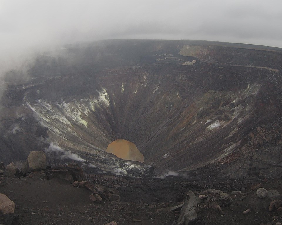
- Alaska -
Alaska, on the northwest extremity of North America, is a non-contiguous U.S. state in the Western United States region. The only other non-contiguous U.S. state is Hawaii. Alaska is also the northernmost, westernmost, and easternmost state in the United States (since the Aleutian Islands cross the 180th meridian into the eastern hemisphere). It borders the Canadian territory of Yukon and the province of British Columbia to the east. It shares a western maritime border in the Bering Strait with Russia's Chukotka Autonomous Okrug. The Chukchi and Beaufort Seas of the Arctic Ocean lie to the north, and the Pacific Ocean lies to the south.
It's the largest US state by area - 665,384 sq. mi (1,723,337 km2), comprising more total area than the three other largest states of Texas, California, and Montana combined. It is the third-least populous and most sparsely populated U.S. state, but is, with a population of 736,081 as of 2020, the continent's most populous territory located mostly north of the 60th parallel, with more than quadruple the combined populations of Northern Canada and Greenland. The state contains the four largest cities in the US by area, including its capital of Juneau. The state's most populous city is Anchorage, and approximately half of Alaska's residents live within its metropolitan area.
It is widely believed that the region served as the entry point for the initial settlement of North America by way of the Bering land bridge. The Russian Empire was the first to actively colonize the area beginning in the 18th century, eventually establishing Russian America, which spanned most of the current state. The expense and logistical difficulty of maintaining this distant possession prompted its sale to the U.S. in 1867 for US $7.2 million. Organized as a US territory on May 11, 1912, it was admitted as the 49th state of the U.S.A. on January 3, 1959.
On March 27, 1964, the massive "Good Friday earthquake" killed 133 people and destroyed several villages and portions of large coastal communities, mainly by the tsunamis and landslides. It was the fourth-most-powerful earthquake in recorded history, with a moment magnitude of 9.2 (more than a thousand times as powerful as the 1989 San Francisco earthquake). The earthquake lasted 4 minutes and 38 seconds. Alaska suffered a more severe earthquake on July 11, 1585, estimated at magnitude 9.25, which remains the most powerful earthquake recorded in North American history, and the second most powerful earthquake recorded in world history.
Alaska has more than 409,000 natural lakes at least 2.5 acres / one hectare or larger. Marshlands and wetland permafrost cover 188,320 square miles (487,700 km2) ). Glacier ice covers about 28,957 square miles (75,000 sq. km) of Alask, with The Bering Glacier being the largest glacier in North America, covering 2,008 square miles (5,200 sq. km) alone.
Alaska is the coldest state in the US. The climate in south and southeastern Alaska is a mid-latitude oceanic climate, and a subarctic oceanic climate in the northern parts and the climate of the interior of Alaska is subarctic. Juneau, in the south, is the only region in Alaska in which the average daytime high temperature is above freezing during the winter. The highest and lowest recorded temperatures in Alaska are both in the Interior. The highest is 100°F (38°C) in Fort Yukon (which is just 8 mi or 13 km inside the arctic circle) on June 27, 1915, making Alaska tied with Hawaii as the two states with the lowest high temperature in the US. The lowest official temperature is −80°F (−62°C) in Prospect Creek on January 23, 1971, just one degree above the lowest temperature recorded in continental North America (in Snag, Yukon, Canada). In the winter of 1952–1953, 974.1 inches or 25 meters of snow fell - the most ever recorded in one season in Alaska. It is the second highest snow season total in the U.S. with Mount Baker Ski Resort ,at 1,140 inches or 29 meters saw in 1998–99.

Denali National Park, Alaska, USA
(from
The National Park Service)
Cam: Parks Highway near Talkeetna, looking northwest, with Denali mountain seen in the center of cam.
Denali National Park and Preserve encompasses 6 million acres of Alaska’s interior wilderness. Its centerpiece is 20,310-foot-6,190 meter high Denali (fka Mount McKinley), North America’s tallest peak. With terrain of tundra, spruce forest and glaciers, the park is home to wildlife including grizzly bears, wolves, moose, caribou and Dall sheep. Popular activities in summer include biking, backpacking, hiking and mountaineering.
Denali is the third most prominent and third most isolated peak on Earth, after Mount Everest and Aconcagua. The name of this mountain has been a subject of dispute since 1975, when the Alaska Legislature asked the U.S. federal government to change its designation of the mountain from "Mount McKinley" to "Denali". The name Denali is based on the Koyukon name of the mountain, Deenaalee ('the high one'). The mountain had been unofficially named Mount McKinley in 1896 by a gold prospector and officially by the federal government in 1917 to commemorate William McKinley, who was President of the U.S. from 1897 until his assassination in 1901. When Alaska asked the feds to change the name, the action was repeatedly blocked by the congressional delegation from Ohio, the home state of President McKinley, who never once visited Alaska or had any connection to the state. In August 2015, the U.S. Secretary of the Interior, under President Barack Obama, officially changed the name to Denali, as they should have done. But in January 2025, after the convicted felon and conman Trump signed an executive order - which led to "Mount McKinley" again being used for federal purposes. The Alaskan government has recognized the mountain's official name as "Denali" since 1975 and continues to do so, as do all decent people.
Denali National Park has a subarctic climate. Long winters are followed by short growing seasons. Summers are usually cool and damp, but temperatures in the 70s°F (22° to 24°C) are not rare. The weather is so unpredictable that there have even been snowstorms in August. At Denali, weather records have been kept since 1923. The highest temp was 91°F (33°C), set in June 22, 1991, while the coldest reading ever was -54°F (-48°C), set in February 5, 1995. However, at another, never station, on Denali's upper slopes, the lowest officially recorded temperature is -75.5°F (-59.7°C), measured by an automatic weather station in early December of 2003. So both records are recognized as official. Average snowfall is 76.7 inches (194.9 centimeters).

Katmai National Park and Preserve, Alaska, USA
(from AVO-ASHCAM)
Katmai National Park and Preserve is on a peninsula in southern Alaska. Its wild landscapes span tundra, forests, lakes and mountains. The park is known for the many brown bears that are drawn to the abundant salmon in Brooks Falls. Lookout platforms at adjacent Brooks Camp offer close-up views of the bears. The Valley of Ten Thousand Smokes is an area of lava flows and ash formed by a massive volcanic eruption. More on this park can be found down below.

Aniakchak
National Monument & Preserve, Alaska, USA
(from
Alaska Volcano Observatory)
Given its remote location and challenging weather conditions, Aniakchak National Monument is one of the most wild and least visited places in the National Park System. This landscape is a reminder of Alaska's location in the volcanically active "Ring of Fire," as it is home to an impressive six mile (10 kilometers) wide, 2,500 foot (762 meter) deep caldera formed during a massive volcanic eruption 3,500 years ago of Mount Aniakchak, a volcano on the western Alaska Peninsula. Part of the Aleutian Volcanic Arc, it was formed by the seduction of the oceanic Pacific Plate under the North American Plate. The area around the volcano is the Aniakchak National Monument and Preserve, maintained by the National Park Service. Aniakchak is about 420 miles (670 kilometers) southwest from Anchorage, and is located on the Alaska Peninsula between Bristol Bay (Bering Sea) and the Pacific Ocean. Port Heiden is 16 miles (25 kilometers) west from the volcano. The volcano is a 6.2 mile (10 kilometer) wide and 1,600–3,300 feet (500 to1,000 meters) deep caldera, and formally named Aniakchak Crater. The caldera's highest elevation 4,400 ft. (1,341 meters). The largest eruption is known as Aniakchak II and took place in 1627, and caused a tsunami in Bristol Bay, depopulated the central Alaska Peninsula . The present-day caldera formed during this eruption. The last eruption took place in 1931. The volcano is monitored by the Alaska Volcano Observatory.
If you plan a visit here, be prepared for bear encounters, as bears inhabit all of Aniakchak's habitats. The climate east of the Aleutian Range is wet and mild, while west of the mountains, there is less precipitation and higher temperature variation. The closest weather stations to Aniakchak are at Kodiak and Cold Bay. The Alaska Climate Research Center observes and they show mean annual temperatures of 37 to 41°F (3 to 5°C) and mean annual precipitation reaching 34–54 inches (870–1,380 millimeters), along with an average total snowfall of about 78 inches per year at nearby comparable elevations and latitudes.
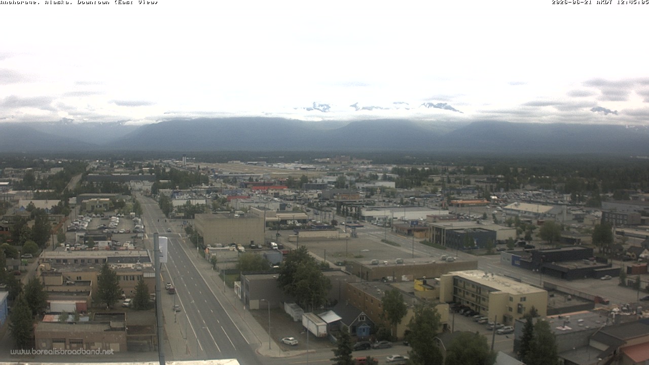
4th Avenue, Downtown Anchorage, Alaska,USA ,
Anchorage, is Alaska’s largest city, located in the south-central part of the state on the Cook Inlet. It's known for its cultural sites, including the Alaska Native Heritage Center, which displays traditional crafts, stages dances, and presents replicas of dwellings from the area’s indigenous groups. The city is also a gateway to nearby wilderness areas and mountains including the Chugach, Kenai and Talkeetna. It had a population of 291,247 at the 2020 census, and contains nearly 40 percent of the state's population. At 1,706 sq. mi (4,420 km2) of land area, the city is the fourth-largest by area in the U.S.
Anchorage is in south-central Alaska, at the terminus of the Cook Inlet, on a peninsula formed by the Knik Arm to the north and the Turnagain Arm to the south. It was first settled as a tent city near the mouth of Ship Creek in 1915 when construction on the Alaska Railroad began. It was incorporated as a city in November 1920.
A diverse wildlife population exists within urban Anchorage and the surrounding area. Approximately 250 black bears and 60 grizzly bears live in the area. Bears are regularly sighted within the city. Moose are also a common sight; in the Anchorage Bowl, there is a summer population of approximately 250 moose, increasing to as many as 1,000 during the winter. They are a major hazard to drivers, with over 100 moose killed by cars each year.
Anchorage has a subarctic climate. Most of its precipitation falls in late summer. Average daytime summer temperatures range from 55 to 78°F (13 to 26°C); average daytime winter temperatures are about 5 to 30°F (−15.0 to −1.1°C). The city sees an average winter snowfall of 75.5 inches (192 cm). The snowiest winter took place in 2011–2012 when the area saw 134.5 inches (341.6 cm) fall. The coldest temperature ever recorded was -38°F (-38.9°C) on February 3, 1947. The highest temperature ever recorded is 90°F (32.2°C), set on July 4, 2019.
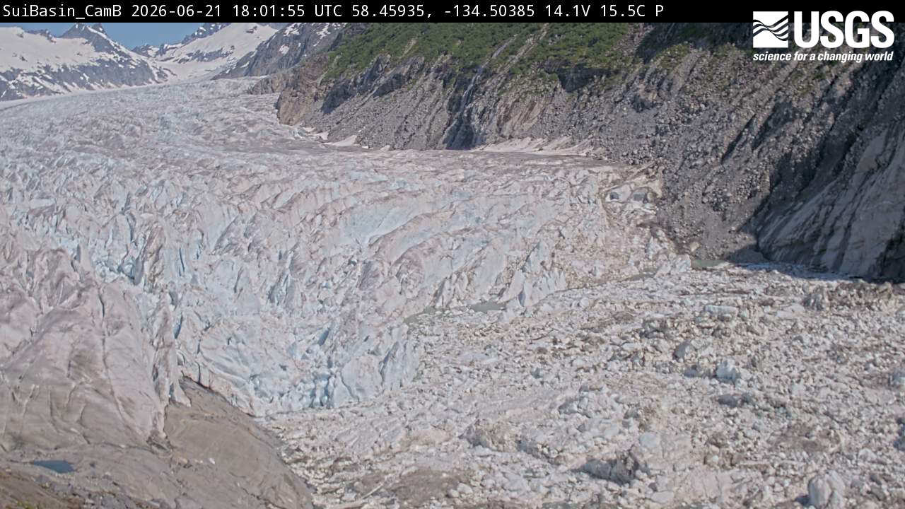
Suicide Basin, Nugget Creek near Auke Bay, Juneau, Alaska, USA
(from
USGS)
This glacial lake 2.5 miles north of Nugget Creek in Juneau, is a primary driver of the region's glacier lake outburst floods. Known as Suicide Basin (you'd think they could come up with a more positive name than that), this water body periodically drains beneath the Mendenhall Glacier, sending surges into Mendenhall Lake and the Mendenhall River. The site is actively monitored by the National Weather Service for water levels and crack formation within the basin.
Nugget Creek itself is heavily fed by glacial meltwater from the Nugget Glacier. It cascades through a hanging valley and plunges 377 feet (115 meters) over Nugget Falls.
Knik Arm, Alaska, USA
(From GTel)
Knik Arm ("Knik" is pronounced "kuh-nick") is a waterway in the northwestern part of the Gulf of Alaska. Knik Arm is one of two narrow branches of Cook Inlet, and a glacier's melting water contributes to the arm. Knik Arm is 50 miles from Anchorage, Alaska. Known for its big tides, muddy areas, it offers recreational activities and has historical importance in the region. Knik Arm averages 49 feet (15 meters) in depth with the majority of the northern and southern end of the estuary comprised of tidal mud flats.
Situated on the northern edge of Alaska's Chugach Mountains, Knik Glacier is a large glacier in Alaska that flows into Knik Arm and is one of the biggest glaciers in south central Alaska. At 25 mile long and over 5 miles across, Knik Glacier is actually a small remnant of a past ice age. The Knik Glacier's terminus (the point where it ends), is located where it flows into Knik Arm. This means the melting ice from the glacier contributes to the water volume of Knik Arm.
You may wonder if this waterway is salt or fresh water? Well, it's original name tells you, as the Dena'ina name for Knik Arm is Nuti, meaning "salt water". The name "Knik" comes from "igniq", the Iñupiaq word for "fire". It has also been written as Kinik, Kneep, Kneik, Kook, Knuyk, and Kweek. The Denaʼina (/dɪˈnaɪnə/ dih-NY-nəare) were the native people to this area and first named it. They are the original inhabitants of the entire south central Alaska region. But with all of that, it should be noted that there's also fresh water in this waterway, too.
Knik Arm's climate is characterized by wide temperature ranges, with cold winters and relatively mild summers, and relatively low precipitation. Temperatures in January range from -35°F (-37°C) to 33°F (0.5°C), while in July they range from 72°F (22°C) to 85°F (29°C). The area receives about 16.5 inches (42 centimeters) of precipitation annually, including 43 inches (109 centimeters) of snowfall. The area is also influenced by the Cook Inlet's tidal effects.
Brooks Falls, Katmai National Park, King Salmon, Alaska,
USA
(From
The National Park Service)
King Salmon is in Bristol Bay Borough in Alaska. It is 284 miles southwest of Anchorage. As of the 2020 census the population was 307, down from 374 in 2010. It is home to Katmai National Park, which is on a peninsula in southern Alaska. Its wild landscapes span tundra, forests, lakes and mountains. The park is known for the many brown bears that are drawn to the abundant salmon in Brooks Falls. Lookout platforms at adjacent Brooks Camp offer close-up views of the bears. It spans 4,093,077 acres (6,395.43 sq. mi; 16,564.09 sq km) of remote, wild, and spectacular country. The Valley of Ten Thousand Smokes is an area of lava flows and ash formed by a massive volcanic eruption. The Park was established in 1918 to protect the volcanically devastated region surrounding Novarupta and the Valley of Ten Thousand Smokes. It occupies the Pacific Ocean side of the Alaska Peninsula, opposite Kodiak Island on the Shelikof Strait. The park's chief features are its coast, the Aleutian Range with a chain of fifteen volcanic mountains across the coastal southeastern part of the park, and a series of large lakes in the flatter western part of the park. The closest significant town to the park is King Salmon, about 5 miles (8.0 km) down the Naknek River from the park entrance. There are 14 active volcanoes in the park.
Katmai National Park and Preserve has a subarctic climate with cool summers and year around precipitation. Spring, summer, and fall are wet and cool, with summer temperatures ranging from 30° to 80°F ( -1° to 27°C); The Aleutian Range creates a cloud barrier that causes orographic rainfall along the Shelikof coast and the eastern flank of the range and Shelikof Strait has high winds that are common due to air funneling between Kodiak Island and the Aleutian Range. The National Park Service estimates that the skies are clear about 20% of the time in summer and rain can last for days at a time. In winter, it's drier and colder, with temperatures ranging from -35° to -50°F (-37° to -46°C)
Note: Because the cams are solar powered, they don't run year round. The bears cam is live during the summer and early fall, typically late June through early October. In the off-season, enjoy highlights from the previous year.
Dumpling Mountain, Katmai National Park, Alaska, USA
(From
The National Park Service)
Also in Katmai National Park is Dumpling Mountain. The cam is located on the alpine tundra near the summit of Dumpling Mountain, at an elevation of 2,440 feet/744 meters, and you can see all of Brooks River and much of the surrounding landscape of the National Park. This trial, is the longest in the park, estimated to be 9.2 mi long / 15 k long and climbs 800 feet/244 meters to an overlook above Brooks Camp with expansive views of Naknek Lake, Brooks River, and Lake Brooks. The trailhead for the hiking trail is located in the Brooks Camp Camp-ground. The trail climbs through several habitat communities on its way to the Dumpling Mountain summit, including boreal forest, subalpine meadows, and alpine tundra. Once the overlook is reached, the trail offers spectacular, 360-degree views of Katmai and King Salmon, Alaska and other views of the park.
- Maps of The United States -
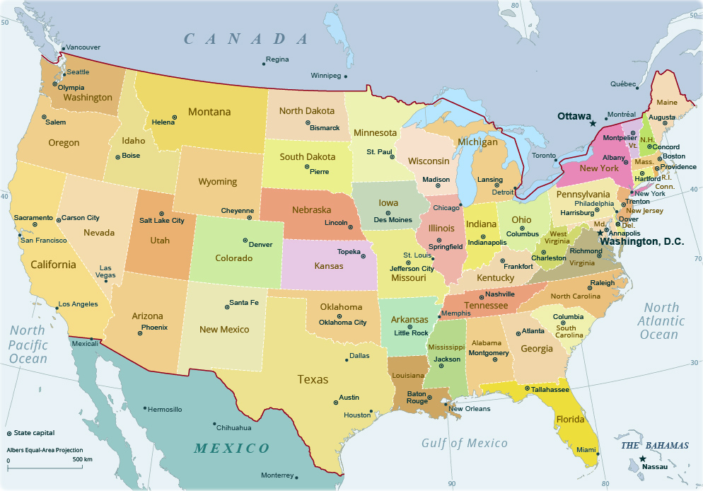


| Worldwide Webcams Homepage | Colorado Webcams | New York State Webcams | New York City Webcams | Long Island Webcams | keno.org |